Dayton night lights from space
Night Light of Dayton (Minnesota) from space (United States) Src. Average luminocity for 10x10km area is 33.2742% and for 50x50km: 26.5982%.
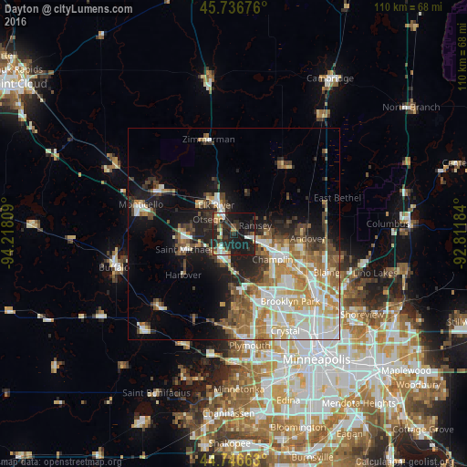
Analysis of Dayton night lights 2016
Square area 10x10 km:
 4.85%
4.85%90-99
3.94%80-89
4.09%70-79
3.94%60-69
3.48%50-59
1.52%40-49
3.03%30-39
7.58%20-29
20.76%10-19
39.09%0-9
7.73%Square area 50x50 km:
5.57%90-99
5.34%80-89
3.2%70-79
3.32%60-69
4.05%50-59
3.54%40-49
3.22%30-39
2.81%20-29
4.65%10-19
10.54%0-9
53.75%Clear (daylight) street map image can be seen on geolist.org.
Map coordinates:
45° 44' 12.3" North, 94° 13' 5.1" West
45° 14' 37.9" North, 93° 30' 53.9" West
44° 44' 47.9" North, 92° 48' 42.6" West
Some cities around Dayton sort by population:
• Ramsey
5.4 km =3.4 mi,  69°
69°
• Elk River
7.8 km =4.8 mi,  328°
328°
• Champlin
11.1 km =6.9 mi,  123°
123°
• Anoka
11.2 km =7 mi, 117°
• Saint Michael
12.3 km =7.6 mi,  252°
252°
• Otsego
6.9 km =4.3 mi,  299°
299°
• Rogers
6.8 km =4.2 mi,  205°
205°
• Albertville
10.9 km =6.8 mi,  266°
266°
5023970 (p: 5,096)
Sources (retrieved 2019-11-25):
» Earth at Night: Flat Maps 2012, 2016