Cudahy night lights from space
Night Light of Cudahy (Wisconsin) from space (United States) Src. Average luminocity for 10x10km area is 63.627% and for 50x50km: 34.6744%.
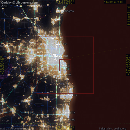
Analysis of Cudahy night lights 2016
Square area 10x10 km:
 34.6%
34.6%90-99
16.83%80-89
2.54%70-79
2.22%60-69
1.11%50-59
0.95%40-49
1.11%30-39
5.4%20-29
11.11%10-19
13.49%0-9
10.63%Square area 50x50 km:
13.07%90-99
6.66%80-89
2.59%70-79
3.52%60-69
4.86%50-59
4.38%40-49
3.09%30-39
2.86%20-29
5.09%10-19
5.87%0-9
48.03%Clear (daylight) street map image can be seen on geolist.org.
Map coordinates:
43° 28' 19.8" North, 88° 33' 52.6" West
42° 57' 35.1" North, 87° 51' 41.3" West
42° 26' 34.9" North, 87° 9' 30.1" West
Some cities around Cudahy sort by population:
• Milwaukee
9.5 km =5.9 mi,  337°
337°
• West Allis
13.4 km =8.3 mi,  298°
298°
• Greenfield
12.3 km =7.6 mi,  270°
270°
• Oak Creek
8.2 km =5.1 mi,  180°
180°
• South Milwaukee
5.5 km =3.4 mi, 179°
• Greendale
11.1 km =6.9 mi,  258°
258°
• Shorewood
14.5 km =9 mi,  351°
351°
• Saint Francis
1.6 km =1 mi, 303°
5249871 (p: 18,353)
Sources (retrieved 2019-11-25):
» Earth at Night: Flat Maps 2012, 2016