Crystal Lake night lights from space
Night Light of Crystal Lake (Illinois) from space (United States) Src. Average luminocity for 10x10km area is 65.4985% and for 50x50km: 41.8196%.
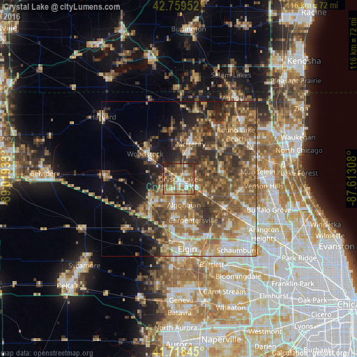

Analysis of Crystal Lake night lights 2016
Square area 10x10 km:
 7.42%
7.42%90-99
9.09%80-89
11.52%70-79
11.36%60-69
13.94%50-59
25.3%40-49
11.67%30-39
6.67%20-29
2.58%10-19
0.45%0-9
0%Square area 50x50 km:
4.46%90-99
5.66%80-89
6.15%70-79
6.49%60-69
8.66%50-59
11.16%40-49
9.47%30-39
6.8%20-29
7.39%10-19
7.78%0-9
25.99%Clear (daylight) street map image can be seen on geolist.org.
Map coordinates:
42° 45' 34.3" North, 89° 1' 9.6" West
42° 14' 28.1" North, 88° 18' 58.3" West
41° 43' 6.4" North, 87° 36' 47.1" West
Some cities around Crystal Lake sort by population:
• Algonquin
8.6 km =5.3 mi,  167°
167°
• Lake in the Hills
6.7 km =4.2 mi,  190°
190°
• McHenry
11 km =6.8 mi,  21°
21°
• Huntley
12.3 km =7.6 mi,  228°
228°
• Woodstock
13.6 km =8.5 mi,  306°
306°
• Cary
7.2 km =4.5 mi,  116°
116°
• Island Lake
10.9 km =6.8 mi,  69°
69°
• Lakemoor
13.7 km =8.5 mi,  44°
44°
4889229 (p: 40,448)
Sources (retrieved 2019-11-25):
» Earth at Night: Flat Maps 2012, 2016