Cary night lights from space
Night Light of Cary (Illinois) from space (United States) Src. Average luminocity for 10x10km area is 60.8818% and for 50x50km: 53.5381%.
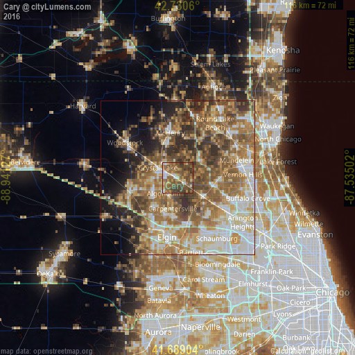
Analysis of Cary night lights 2016
Square area 10x10 km:
 5.61%
5.61%90-99
6.36%80-89
8.33%70-79
8.94%60-69
13.94%50-59
20.61%40-49
26.67%30-39
9.39%20-29
0.15%10-19
0%0-9
0%Square area 50x50 km:
8.47%90-99
9.65%80-89
7.93%70-79
7.73%60-69
10.93%50-59
12.21%40-49
9.59%30-39
6.47%20-29
6.96%10-19
6.71%0-9
13.36%Clear (daylight) street map image can be seen on geolist.org.
Map coordinates:
42° 43' 50.2" North, 88° 56' 28.6" West
42° 12' 43.1" North, 88° 14' 17.3" West
41° 41' 20.5" North, 87° 32' 6.1" West
Some cities around Cary sort by population:
• Crystal Lake
7.2 km =4.5 mi,  296°
296°
• Carpentersville
10.2 km =6.3 mi,  189°
189°
• Algonquin
6.9 km =4.3 mi,  221°
221°
• Lake in the Hills
8.3 km =5.2 mi,  246°
246°
• Lake Zurich
12 km =7.5 mi,  97°
97°
• Wauconda
9.7 km =6 mi,  57°
57°
• Barrington
10.6 km =6.6 mi,  127°
127°
• Island Lake
8.1 km =5 mi,  28°
28°
4886738 (p: 17,965)
Sources (retrieved 2019-11-25):
» Earth at Night: Flat Maps 2012, 2016