Crown Point night lights from space
Night Light of Crown Point (Indiana) from space (United States) Src. Average luminocity for 10x10km area is 59.2738% and for 50x50km: 37.8771%.
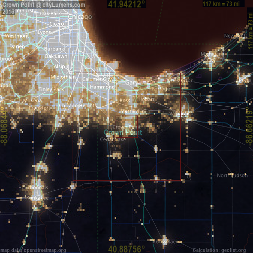
Analysis of Crown Point night lights 2016
Square area 10x10 km:
 5.1%
5.1%90-99
9.35%80-89
10.71%70-79
9.69%60-69
15.14%50-59
13.61%40-49
9.18%30-39
13.78%20-29
10.2%10-19
3.23%0-9
0%Square area 50x50 km:
8.45%90-99
7.24%80-89
5.26%70-79
5.58%60-69
6.52%50-59
5.67%40-49
4.11%30-39
4.17%20-29
6.28%10-19
7.46%0-9
39.26%Clear (daylight) street map image can be seen on geolist.org.
Map coordinates:
41° 56' 31.6" North, 88° 4' 6.4" West
41° 25' 1.1" North, 87° 21' 55.1" West
40° 53' 15.2" North, 86° 39' 43.9" West
Some cities around Crown Point sort by population:
• Merrillville
7.8 km =4.8 mi,  20°
20°
• Schererville
10.1 km =6.3 mi,  312°
312°
• Griffith
13.3 km =8.3 mi,  338°
338°
• Saint John
9.5 km =5.9 mi,  292°
292°
• Cedar Lake
8.6 km =5.3 mi,  227°
227°
• Lowell
14.7 km =9.1 mi,  198°
198°
• Lakes of the Four Seasons
12.7 km =7.9 mi,  93°
93°
• Winfield
7.6 km =4.7 mi,  99°
99°
4919451 (p: 28,879)
Sources (retrieved 2019-11-25):
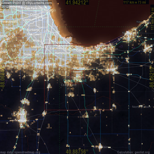
» Earth at Night: Flat Maps 2012, 2016