Crawfordsville night lights from space
Night Light of Crawfordsville (Indiana) from space (United States) Src. Average luminocity for 10x10km area is 32.4416% and for 50x50km: 2.367%.
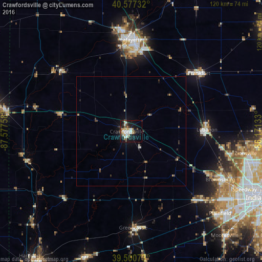
Analysis of Crawfordsville night lights 2016
Square area 10x10 km:
 5.84%
5.84%90-99
7.31%80-89
4.71%70-79
2.92%60-69
1.46%50-59
5.68%40-49
3.08%30-39
2.92%20-29
4.87%10-19
31.66%0-9
29.55%Square area 50x50 km:
0.25%90-99
0.35%80-89
0.35%70-79
0.2%60-69
0.17%50-59
0.38%40-49
0.38%30-39
0.38%20-29
0.57%10-19
1.86%0-9
95.12%Clear (daylight) street map image can be seen on geolist.org.
Map coordinates:
40° 34' 38.4" North, 87° 34' 39.3" West
40° 2' 28.1" North, 86° 52' 28" West
39° 30' 2.6" North, 86° 10' 16.8" West
Some cities around Crawfordsville sort by population:
• Lafayette
41.8 km =26 mi,  359°
359°
• West Lafayette
42.9 km =26.7 mi, 356°
• Brownsburg
46.2 km =28.7 mi,  118°
118°
• Frankfort
40.7 km =25.3 mi,  49°
49°
• Lebanon
34.5 km =21.4 mi,  88°
88°
• Greencastle
44.1 km =27.4 mi,  178°
178°
• Danville
43.1 km =26.8 mi,  136°
136°
• Whitestown
45.3 km =28.1 mi,  96°
96°
4919381 (p: 16,024)
Sources (retrieved 2019-11-25):
» Earth at Night: Flat Maps 2012, 2016