Brownsburg night lights from space
Night Light of Brownsburg (Indiana) from space (United States) Src. Average luminocity for 10x10km area is 59.4575% and for 50x50km: 42.5441%.
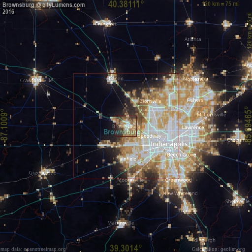
Analysis of Brownsburg night lights 2016
Square area 10x10 km:
 6.97%
6.97%90-99
6.63%80-89
7.99%70-79
12.24%60-69
18.03%50-59
12.76%40-49
9.18%30-39
13.1%20-29
9.69%10-19
3.4%0-9
0%Square area 50x50 km:
11.49%90-99
10.41%80-89
6.01%70-79
6.86%60-69
5.31%50-59
4.23%40-49
2.96%30-39
3.06%20-29
4.29%10-19
7.14%0-9
38.24%Clear (daylight) street map image can be seen on geolist.org.
Map coordinates:
40° 22' 52" North, 87° 6' 3.2" West
39° 50' 36.2" North, 86° 23' 52" West
39° 18' 5" North, 85° 41' 40.7" West
Some cities around Brownsburg sort by population:
• Plainfield
15.5 km =9.6 mi,  180°
180°
• Zionsville
16.6 km =10.3 mi,  44°
44°
• Fairfield Heights
2.1 km =1.3 mi,  141°
141°
• Broad Ripple
22 km =13.7 mi,  83°
83°
• Avon
9 km =5.6 mi, 181°
• Speedway
12.1 km =7.5 mi,  112°
112°
• Danville
14.3 km =8.9 mi,  230°
230°
• Whitestown
17.7 km =11 mi,  14°
14°
4255056 (p: 24,996)
Sources (retrieved 2019-11-25):
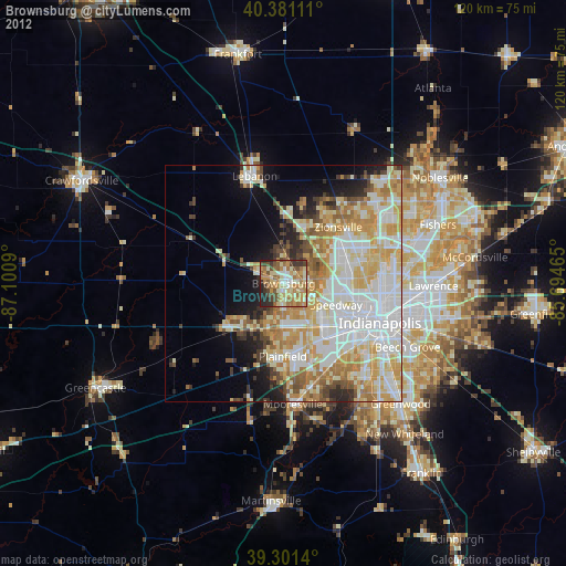
» Earth at Night: Flat Maps 2012, 2016