Corbin night lights from space
Night Light of Corbin (Kentucky) from space (United States) Src. Average luminocity for 10x10km area is 61.2614% and for 50x50km: 11.4749%.
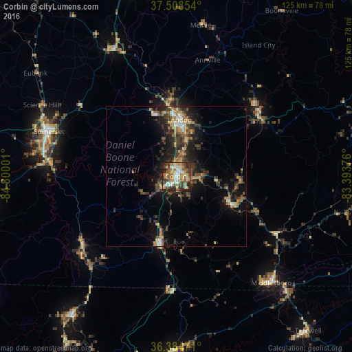
Analysis of Corbin night lights 2016
Square area 10x10 km:
 7.47%
7.47%90-99
11.2%80-89
13.64%70-79
10.71%60-69
7.14%50-59
11.85%40-49
9.42%30-39
13.8%20-29
13.15%10-19
1.62%0-9
0%Square area 50x50 km:
0.81%90-99
0.92%80-89
1.57%70-79
1.61%60-69
1.53%50-59
2.14%40-49
2.13%30-39
3.62%20-29
4.07%10-19
7.34%0-9
74.26%Clear (daylight) street map image can be seen on geolist.org.
Map coordinates:
37° 30' 30.7" North, 84° 48' 0" West
36° 56' 55.3" North, 84° 5' 48.8" West
36° 23' 5" North, 83° 23' 37.5" West
Some cities around Corbin sort by population:
• Berea
71.2 km =44.2 mi,  345°
345°
• Somerset
47.8 km =29.7 mi,  289°
289°
• Middlesboro
50.8 km =31.6 mi,  138°
138°
• London
20.1 km =12.5 mi,  3°
3°
• LaFollette
62.9 km =39.1 mi,  181°
181°
• Monticello
68.2 km =42.4 mi,  258°
258°
• Hazard
86.8 km =53.9 mi,  67°
67°
• Williamsburg
23.5 km =14.6 mi,  193°
193°
4288656 (p: 7,389)
Sources (retrieved 2019-11-25):
» Earth at Night: Flat Maps 2012, 2016