Columbia night lights from space
Night Light of Columbia (Tennessee) from space (United States) Src. Average luminocity for 10x10km area is 59.0664% and for 50x50km: 11.5513%.
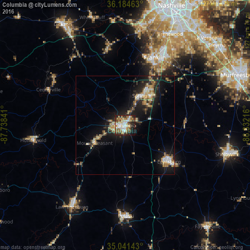
Analysis of Columbia night lights 2016
Square area 10x10 km:
 12.59%
90-99
9.44%80-89
10.66%70-79
9.44%60-69
8.57%50-59
8.92%40-49
4.72%30-39
8.22%20-29
17.83%10-19
8.57%0-9
1.05%Square area 50x50 km:
1.25%90-99
1.25%80-89
1.99%70-79
1.59%60-69
1.74%50-59
1.19%40-49
1.07%30-39
2.15%20-29
4.21%10-19
10.09%0-9
73.48%Clear (daylight) street map image can be seen on geolist.org.
Map coordinates:
36° 11' 4.7" North, 87° 44' 18.3" West
35° 36' 54.3" North, 87° 2' 7" West
35° 2' 29.1" North, 86° 19' 55.8" West
Some cities around Columbia sort by population:
• Franklin
37.6 km =23.4 mi,  23°
23°
• Spring Hill
17.9 km =11.1 mi,  32°
32°
• Brentwood Estates
51.1 km =31.8 mi, 26°
• Lewisburg
28.9 km =18 mi,  129°
129°
• Lawrenceburg
49.5 km =30.8 mi,  213°
213°
• Fairview
41.5 km =25.8 mi,  349°
349°
• Pulaski
46.2 km =28.7 mi,  179°
179°
• Nolensville
49.9 km =31 mi,  41°
41°
4614867 (p: 36,800)
Sources (retrieved 2019-11-25):
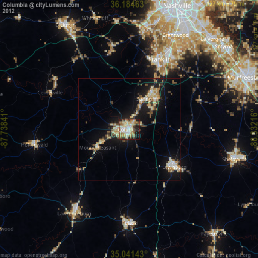
» Earth at Night: Flat Maps 2012, 2016