Franklin night lights from space
Night Light of Franklin (Tennessee) from space (United States) Src. Average luminocity for 10x10km area is 76.0568% and for 50x50km: 35.4589%.
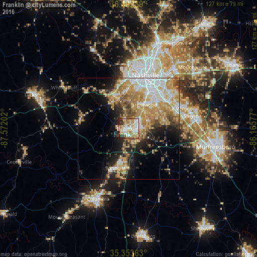
Analysis of Franklin night lights 2016
Square area 10x10 km:
 17.4%
17.4%90-99
21.43%80-89
12.45%70-79
14.47%60-69
13.19%50-59
5.13%40-49
3.48%30-39
5.49%20-29
6.78%10-19
0.18%0-9
0%Square area 50x50 km:
6.19%90-99
6.15%80-89
6.63%70-79
6.79%60-69
6.52%50-59
4.13%40-49
2.74%30-39
3.9%20-29
6.14%10-19
8.68%0-9
42.13%Clear (daylight) street map image can be seen on geolist.org.
Map coordinates:
36° 29' 32.6" North, 87° 34' 19.3" West
35° 55' 30.2" North, 86° 52' 8" West
35° 21' 13.1" North, 86° 9' 56.8" West
Some cities around Franklin sort by population:
• Nashville
27.8 km =17.3 mi,  15°
15°
• Brentwood
14.3 km =8.9 mi,  32°
32°
• Spring Hill
20.1 km =12.5 mi,  195°
195°
• La Vergne
27.7 km =17.2 mi,  68°
68°
• Brentwood Estates
13.7 km =8.5 mi,  35°
35°
• Fairview
23.6 km =14.7 mi,  285°
285°
• Nolensville
18.2 km =11.3 mi,  80°
80°
• Forest Hills
16.1 km =10 mi,  7°
7°
4623560 (p: 72,639)
Sources (retrieved 2019-11-25):
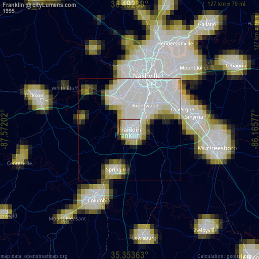
» NASA, Earths city lights 1995
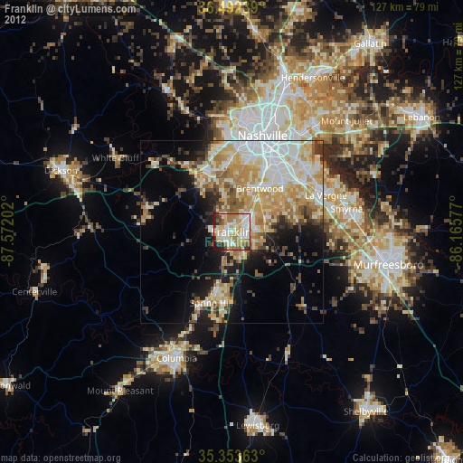
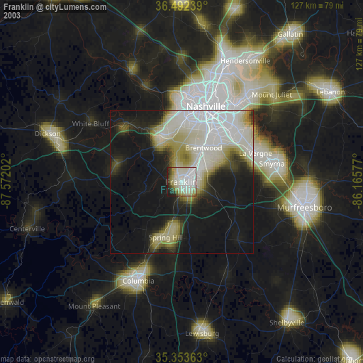
» NASA city lights 2003
» Earth at Night: Flat Maps 2012, 2016