Spring Hill night lights from space
Night Light of Spring Hill (Tennessee) from space (United States) Src. Average luminocity for 10x10km area is 58.729% and for 50x50km: 18.2951%.
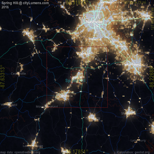
Analysis of Spring Hill night lights 2016
Square area 10x10 km:
 7.69%
7.69%90-99
12.76%80-89
11.71%70-79
13.81%60-69
9.09%50-59
4.9%40-49
3.85%30-39
6.29%20-29
19.06%10-19
9.79%0-9
1.05%Square area 50x50 km:
1.84%90-99
2.18%80-89
3.37%70-79
2.93%60-69
3.19%50-59
2.35%40-49
1.99%30-39
3.49%20-29
6%10-19
11.04%0-9
61.64%Clear (daylight) street map image can be seen on geolist.org.
Map coordinates:
36° 19' 11.1" North, 87° 37' 59.3" West
35° 45' 4.2" North, 86° 55' 48" West
35° 10' 42.6" North, 86° 13' 36.8" West
Some cities around Spring Hill sort by population:
• Franklin
20.1 km =12.5 mi,  15°
15°
• Brentwood
34 km =21.1 mi, 22°
• Columbia
17.9 km =11.1 mi,  212°
212°
• Brentwood Estates
33.3 km =20.7 mi, 24°
• Lewisburg
35.9 km =22.3 mi,  159°
159°
• Fairview
30.9 km =19.2 mi,  326°
326°
• Nolensville
32.4 km =20.1 mi,  46°
46°
• Forest Hills
36.1 km =22.4 mi,  12°
12°
4659446 (p: 36,055)
Sources (retrieved 2019-11-25):
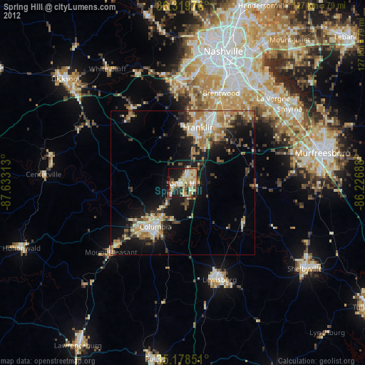
» Earth at Night: Flat Maps 2012, 2016