Chesapeake Ranch Estates night lights from space
Night Light of Chesapeake Ranch Estates (Maryland) from space (United States) Src. Average luminocity for 10x10km area is 28.3503% and for 50x50km: 6.8748%.
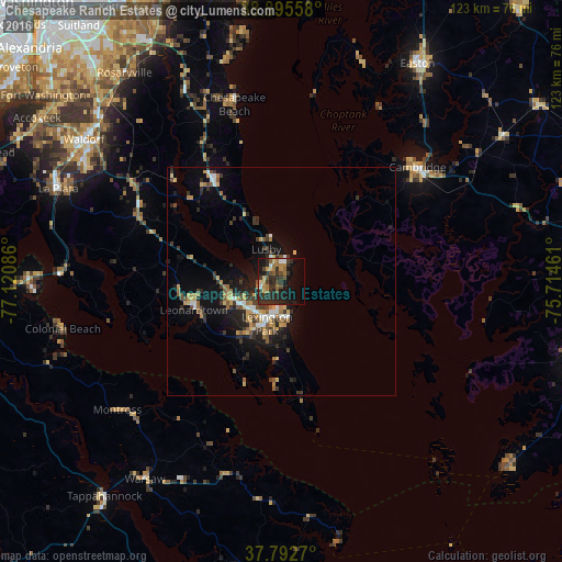
Analysis of Chesapeake Ranch Estates night lights 2016
Square area 10x10 km:
 1.7%
1.7%90-99
1.02%80-89
2.55%70-79
4.59%60-69
6.46%50-59
3.23%40-49
4.76%30-39
8.5%20-29
18.88%10-19
22.79%0-9
25.51%Square area 50x50 km:
0.55%90-99
0.58%80-89
0.9%70-79
1.06%60-69
0.89%50-59
1.02%40-49
0.78%30-39
1.78%20-29
2.39%10-19
5.29%0-9
84.76%Clear (daylight) street map image can be seen on geolist.org.
Map coordinates:
38° 53' 44.1" North, 77° 7' 15.1" West
38° 20' 46.5" North, 76° 25' 3.8" West
37° 47' 33.7" North, 75° 42' 52.6" West
Some cities around Chesapeake Ranch Estates sort by population:
• Waldorf
54.9 km =34.1 mi,  304°
304°
• Saint Charles
53.6 km =33.3 mi, 302°
• St. Charles
52.8 km =32.8 mi, 303°
• Cambridge
38.1 km =23.7 mi,  50°
50°
• California
9.3 km =5.8 mi,  236°
236°
• Lexington Park
9.4 km =5.8 mi,  199°
199°
• La Plata
52.6 km =32.7 mi,  292°
292°
• Brandywine
54 km =33.6 mi,  316°
316°
4351228 (p: 10,519)
Sources (retrieved 2019-11-25):
» Earth at Night: Flat Maps 2012, 2016