California night lights from space
Night Light of California (Maryland) from space (United States) Src. Average luminocity for 10x10km area is 45.6939% and for 50x50km: 6.9888%.
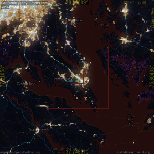
Analysis of California night lights 2016
Square area 10x10 km:
 5.78%
5.78%90-99
5.95%80-89
6.46%70-79
9.52%60-69
6.12%50-59
7.99%40-49
4.42%30-39
9.18%20-29
19.05%10-19
22.79%0-9
2.72%Square area 50x50 km:
0.5%90-99
0.54%80-89
0.85%70-79
1.1%60-69
1.1%50-59
1.08%40-49
0.77%30-39
1.77%20-29
2.51%10-19
5.24%0-9
84.55%Clear (daylight) street map image can be seen on geolist.org.
Map coordinates:
38° 51' 0.3" North, 77° 12' 38.1" West
38° 18' 1.4" North, 76° 30' 26.8" West
37° 44' 47.4" North, 75° 48' 15.6" West
Some cities around California sort by population:
• Waldorf
52.1 km =32.4 mi,  313°
313°
• Saint Charles
50.4 km =31.3 mi, 311°
• St. Charles
49.8 km =30.9 mi, 313°
• Cambridge
47.4 km =29.5 mi,  51°
51°
• Lexington Park
6 km =3.7 mi,  128°
128°
• Chesapeake Ranch Estates
9.3 km =5.8 mi,  56°
56°
• La Plata
48 km =29.8 mi,  301°
301°
• Chesapeake Beach
43 km =26.7 mi,  356°
356°
4350049 (p: 11,857)
Sources (retrieved 2019-11-25):
» Earth at Night: Flat Maps 2012, 2016