Carver night lights from space
Night Light of Carver (Massachusetts) from space (United States) Src. Average luminocity for 10x10km area is 7.5016% and for 50x50km: 19.1927%.
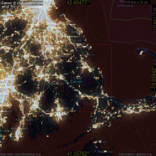
Analysis of Carver night lights 2016
Square area 10x10 km:
 0%
0%90-99
0%80-89
0.16%70-79
1.27%60-69
0.48%50-59
2.54%40-49
0.32%30-39
2.7%20-29
3.17%10-19
5.71%0-9
83.65%Square area 50x50 km:
1.57%90-99
2.34%80-89
2.23%70-79
1.77%60-69
2.73%50-59
3.62%40-49
3.8%30-39
4.26%20-29
6.51%10-19
15.52%0-9
55.65%Clear (daylight) street map image can be seen on geolist.org.
Map coordinates:
42° 24' 17.2" North, 71° 27' 56.4" West
41° 53' 0.4" North, 70° 45' 45.1" West
41° 21' 28.2" North, 70° 3' 33.9" West
Some cities around Carver sort by population:
• Middleborough
12.3 km =7.6 mi,  275°
275°
• East Bridgewater
23.3 km =14.5 mi,  315°
315°
• Kingston
12.7 km =7.9 mi,  14°
14°
• Bridgewater
21.2 km =13.2 mi,  304°
304°
• Halifax
14.5 km =9 mi,  325°
325°
• Plymouth
11.5 km =7.1 mi,  43°
43°
• Middleborough Center
13.6 km =8.5 mi, 275°
• Marion
20.4 km =12.7 mi,  180°
180°
4932388 (p: 11,718)
Sources (retrieved 2019-11-25):
» Earth at Night: Flat Maps 2012, 2016