Carpentersville night lights from space
Night Light of Carpentersville (Illinois) from space (United States) Src. Average luminocity for 10x10km area is 59.8258% and for 50x50km: 56.2386%.
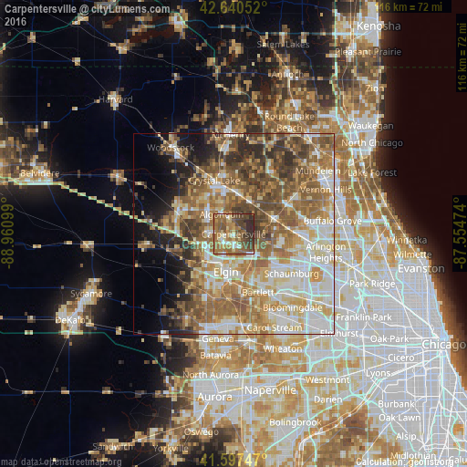
Analysis of Carpentersville night lights 2016
Square area 10x10 km:
 4.7%
4.7%90-99
6.67%80-89
8.18%70-79
6.36%60-69
25.45%50-59
16.21%40-49
16.21%30-39
7.42%20-29
8.79%10-19
0%0-9
0%Square area 50x50 km:
9.88%90-99
10.99%80-89
8.97%70-79
8.27%60-69
10.97%50-59
11.76%40-49
8.65%30-39
5.58%20-29
5.8%10-19
6.22%0-9
12.91%Clear (daylight) street map image can be seen on geolist.org.
Map coordinates:
42° 38' 25.9" North, 88° 57' 39.6" West
42° 7' 16.1" North, 88° 15' 28.3" West
41° 35' 50.9" North, 87° 33' 17.1" West
Some cities around Carpentersville sort by population:
• Elgin
9.5 km =5.9 mi,  191°
191°
• Streamwood
12.5 km =7.8 mi,  148°
148°
• Algonquin
5.8 km =3.6 mi,  328°
328°
• Lake in the Hills
9 km =5.6 mi,  318°
318°
• Cary
10.2 km =6.3 mi,  9°
9°
• Barrington
10.7 km =6.6 mi,  70°
70°
• Gilberts
9.7 km =6 mi,  258°
258°
• West Dundee
3.3 km =2.1 mi,  218°
218°
4886676 (p: 38,512)
Sources (retrieved 2019-11-25):
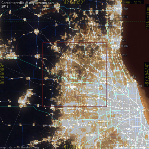
» Earth at Night: Flat Maps 2012, 2016