Elgin night lights from space
Night Light of Elgin (Illinois) from space (United States) Src. Average luminocity for 10x10km area is 84.7889% and for 50x50km: 57.377%.
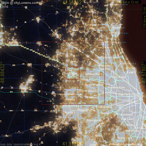
Analysis of Elgin night lights 2016
Square area 10x10 km:
 20.32%
90-99
26.35%80-89
15.87%70-79
18.57%60-69
16.35%50-59
2.54%40-49
0%30-39
0%20-29
0%10-19
0%0-9
0%Square area 50x50 km:
10.29%90-99
11.78%80-89
9.88%70-79
10%60-69
11.86%50-59
10.58%40-49
6.62%30-39
3.68%20-29
4.18%10-19
5.3%0-9
15.82%Clear (daylight) street map image can be seen on geolist.org.
Map coordinates:
42° 33' 26.4" North, 88° 59' 3.6" West
42° 2' 14.1" North, 88° 16' 52.3" West
41° 30' 46.4" North, 87° 34' 41.1" West
Some cities around Elgin sort by population:
• Bartlett
9.2 km =5.7 mi,  120°
120°
• Streamwood
8.6 km =5.3 mi,  98°
98°
• Carpentersville
9.5 km =5.9 mi,  11°
11°
• Hanover Park
12 km =7.5 mi,  110°
110°
• South Elgin
4.9 km =3 mi,  190°
190°
• Gilberts
10.5 km =6.5 mi,  314°
314°
• West Dundee
6.8 km =4.2 mi,  358°
358°
• Pingree Grove
11.5 km =7.1 mi,  287°
287°
4890864 (p: 112,111)
Sources (retrieved 2019-11-25):
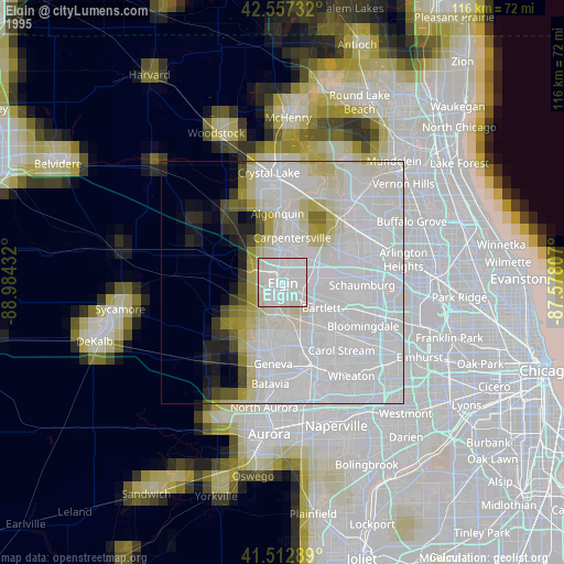
» NASA, Earths city lights 1995
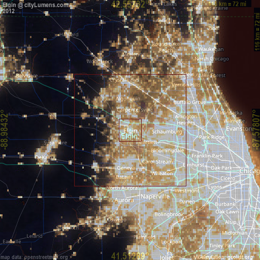
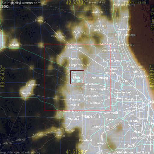
» NASA city lights 2003
» Earth at Night: Flat Maps 2012, 2016