Carol Stream night lights from space
Night Light of Carol Stream (Illinois) from space (United States) Src. Average luminocity for 10x10km area is 84.8063% and for 50x50km: 81.8352%.
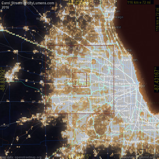
Analysis of Carol Stream night lights 2016
Square area 10x10 km:
 22.06%
90-99
20.63%80-89
21.75%70-79
16.67%60-69
16.83%50-59
2.06%40-49
0%30-39
0%20-29
0%10-19
0%0-9
0%Square area 50x50 km:
23.93%90-99
24.06%80-89
15.66%70-79
11.86%60-69
9.98%50-59
6.3%40-49
2.67%30-39
2.07%20-29
2.17%10-19
1.29%0-9
0.02%Clear (daylight) street map image can be seen on geolist.org.
Map coordinates:
42° 26' 1.1" North, 88° 50' 16.5" West
41° 54' 45.1" North, 88° 8' 5.2" West
41° 23' 13.7" North, 87° 25' 54" West
Some cities around Carol Stream sort by population:
• Wheaton
5.6 km =3.5 mi,  155°
155°
• Hanover Park
9.7 km =6 mi,  354°
354°
• Glendale Heights
5.8 km =3.6 mi,  87°
87°
• Glen Ellyn
6.8 km =4.2 mi,  124°
124°
• West Chicago
6.5 km =4 mi,  241°
241°
• Roselle
9.2 km =5.7 mi,  29°
29°
• Bloomingdale
6.7 km =4.2 mi,  41°
41°
• Winfield
6.1 km =3.8 mi,  200°
200°
4886662 (p: 40,356)
Sources (retrieved 2019-11-25):
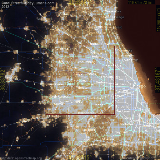
» Earth at Night: Flat Maps 2012, 2016