Alliance night lights from space
Night Light of Alliance (Ohio) from space (United States) Src. Average luminocity for 10x10km area is 38.7789% and for 50x50km: 16.5061%.
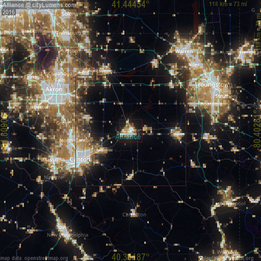
Analysis of Alliance night lights 2016
Square area 10x10 km:
 6.46%
6.46%90-99
6.8%80-89
3.23%70-79
3.06%60-69
6.46%50-59
9.86%40-49
3.06%30-39
2.38%20-29
9.86%10-19
42.52%0-9
6.29%Square area 50x50 km:
1.73%90-99
2.27%80-89
1.64%70-79
1.88%60-69
2.17%50-59
3.37%40-49
3.18%30-39
3.19%20-29
5.24%10-19
10.29%0-9
65.04%Clear (daylight) street map image can be seen on geolist.org.
Map coordinates:
41° 26' 40.3" North, 81° 48' 32.6" West
40° 54' 55.2" North, 81° 6' 21.3" West
40° 22' 54.7" North, 80° 24' 10.1" West
Some cities around Alliance sort by population:
• Canton
26.3 km =16.3 mi,  240°
240°
• Green
31.9 km =19.8 mi,  276°
276°
• North Canton
25.3 km =15.7 mi,  260°
260°
• Salem
21 km =13 mi,  94°
94°
• Ravenna
29.3 km =18.2 mi,  337°
337°
• Louisville
15.6 km =9.7 mi, 236°
• Perry Heights
33.7 km =20.9 mi,  246°
246°
• Canfield
31.4 km =19.5 mi,  67°
67°
5145607 (p: 22,055)
Sources (retrieved 2019-11-25):
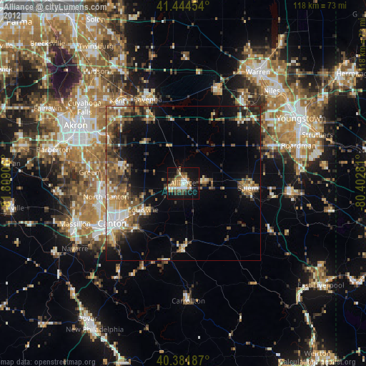
» Earth at Night: Flat Maps 2012, 2016