Adel night lights from space
Night Light of Adel (Georgia) from space (United States) Src. Average luminocity for 10x10km area is 35.2784% and for 50x50km: 6.5118%.
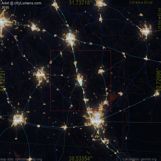
Analysis of Adel night lights 2016
Square area 10x10 km:
 4.95%
4.95%90-99
4.58%80-89
3.48%70-79
9.16%60-69
5.86%50-59
3.48%40-49
2.93%30-39
2.56%20-29
8.24%10-19
39.19%0-9
15.57%Square area 50x50 km:
0.36%90-99
0.41%80-89
0.25%70-79
1.65%60-69
1.28%50-59
0.67%40-49
0.94%30-39
1.65%20-29
1.58%10-19
5.36%0-9
85.83%Clear (daylight) street map image can be seen on geolist.org.
Map coordinates:
31° 44' 13.8" North, 84° 7' 38" West
31° 8' 14.2" North, 83° 25' 26.7" West
30° 32' 0.7" North, 82° 43' 15.5" West
Some cities around Adel sort by population:
• Valdosta
36.5 km =22.7 mi,  157°
157°
• Thomasville
62.6 km =38.9 mi,  237°
237°
• Tifton
35.7 km =22.2 mi,  347°
347°
• Moultrie
35 km =21.7 mi,  277°
277°
• Douglas
68.4 km =42.5 mi,  52°
52°
• Fitzgerald
66.3 km =41.2 mi,  14°
14°
• Sylvester
58.8 km =36.5 mi,  318°
318°
• Camilla
75.5 km =46.9 mi, 277°
4179193 (p: 5,316)
Sources (retrieved 2019-11-25):
» Earth at Night: Flat Maps 2012, 2016