Sylvester night lights from space
Night Light of Sylvester (Georgia) from space (United States) Src. Average luminocity for 10x10km area is 33.1958% and for 50x50km: 6.5346%.
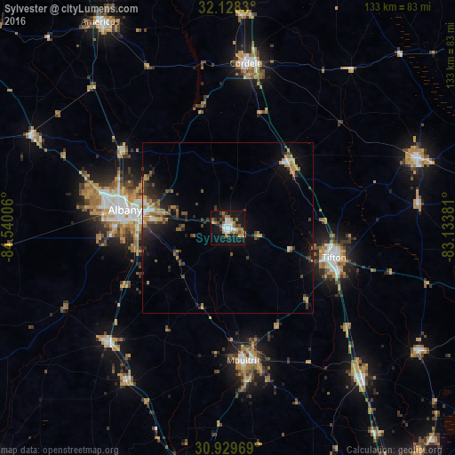
Analysis of Sylvester night lights 2016
Square area 10x10 km:
 5.42%
5.42%90-99
5.77%80-89
1.05%70-79
5.59%60-69
7.87%50-59
2.1%40-49
3.85%30-39
5.07%20-29
2.27%10-19
42.48%0-9
18.53%Square area 50x50 km:
0.52%90-99
0.57%80-89
0.39%70-79
1.27%60-69
1.23%50-59
0.67%40-49
1.01%30-39
1.56%20-29
1.64%10-19
5.5%0-9
85.63%Clear (daylight) street map image can be seen on geolist.org.
Map coordinates:
32° 7' 41.9" North, 84° 32' 24.2" West
31° 31' 51.3" North, 83° 50' 12.9" West
30° 55' 46.9" North, 83° 8' 1.7" West
Some cities around Sylvester sort by population:
• Albany
30.7 km =19.1 mi,  279°
279°
• Tifton
32.4 km =20.1 mi,  106°
106°
• Americus
70.9 km =44.1 mi,  328°
328°
• Moultrie
39.3 km =24.4 mi,  173°
173°
• Cordele
48.4 km =30.1 mi,  6°
6°
• Fitzgerald
59 km =36.7 mi,  69°
69°
• Adel
58.8 km =36.5 mi,  138°
138°
• Camilla
48.7 km =30.3 mi,  226°
226°
4225522 (p: 6,049)
Sources (retrieved 2019-11-25):
» Earth at Night: Flat Maps 2012, 2016