Cahokia night lights from space
Night Light of Cahokia (Illinois) from space (United States) Src. Average luminocity for 10x10km area is 85.4221% and for 50x50km: 65.1206%.
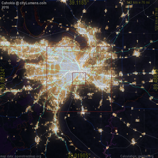
Analysis of Cahokia night lights 2016
Square area 10x10 km:
 30.84%
90-99
24.68%80-89
10.06%70-79
14.77%60-69
9.09%50-59
5.03%40-49
4.55%30-39
0.97%20-29
0%10-19
0%0-9
0%Square area 50x50 km:
18.64%90-99
15.92%80-89
9.13%70-79
10.39%60-69
9.04%50-59
7.53%40-49
4.52%30-39
3.95%20-29
4.06%10-19
6.22%0-9
10.6%Clear (daylight) street map image can be seen on geolist.org.
Map coordinates:
39° 7' 6.6" North, 90° 53' 35.7" West
38° 34' 15.2" North, 90° 11' 24.4" West
38° 1' 8.6" North, 89° 29' 13.2" West
Some cities around Cahokia sort by population:
• St. Louis
6.3 km =3.9 mi,  353°
353°
• East Saint Louis
6.9 km =4.3 mi,  29°
29°
• Affton
12.6 km =7.8 mi,  259°
259°
• Lemay
8.8 km =5.5 mi,  241°
241°
• Richmond Heights
13 km =8.1 mi,  299°
299°
• Maplewood
12.6 km =7.8 mi,  291°
291°
• Shrewsbury
12.9 km =8 mi,  279°
279°
• Centreville
5.8 km =3.6 mi,  76°
76°
4234969 (p: 14,402)
Sources (retrieved 2019-11-25):
» Earth at Night: Flat Maps 2012, 2016