Brownfield night lights from space
Night Light of Brownfield (Texas) from space (United States) Src. Average luminocity for 10x10km area is 20.0192% and for 50x50km: 1.0353%.
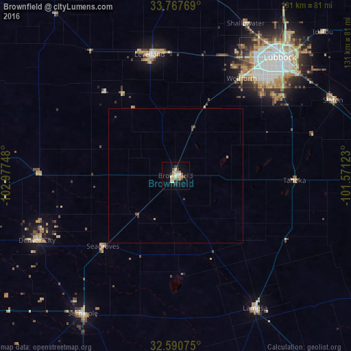
Analysis of Brownfield night lights 2016
Square area 10x10 km:
 1.22%
1.22%90-99
2.27%80-89
4.72%70-79
3.67%60-69
2.8%50-59
1.92%40-49
2.97%30-39
1.4%20-29
1.57%10-19
9.44%0-9
68.01%Square area 50x50 km:
0.05%90-99
0.09%80-89
0.19%70-79
0.21%60-69
0.11%50-59
0.1%40-49
0.3%30-39
0.09%20-29
0.06%10-19
0.38%0-9
98.41%Clear (daylight) street map image can be seen on geolist.org.
Map coordinates:
33° 46' 3.7" North, 102° 58' 38.9" West
33° 10' 52.3" North, 102° 16' 27.7" West
32° 35' 26.7" North, 101° 34' 16.4" West
Some cities around Brownfield sort by population:
• Lubbock
58.8 km =36.5 mi,  41°
41°
• Hobbs
96.4 km =59.9 mi,  236°
236°
• Levelland
46.2 km =28.7 mi,  347°
347°
• Lamesa
57.8 km =35.9 mi,  148°
148°
• Seminole
61.9 km =38.5 mi,  213°
213°
• Littlefield
82 km =51 mi,  356°
356°
• Slaton
65.2 km =40.5 mi,  64°
64°
• Post
83.3 km =51.8 mi,  89°
89°
5517675 (p: 9,736)
Sources (retrieved 2019-11-25):
» Earth at Night: Flat Maps 2012, 2016