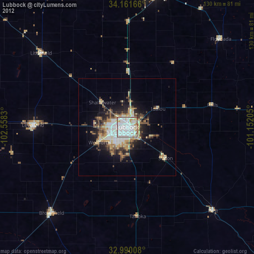
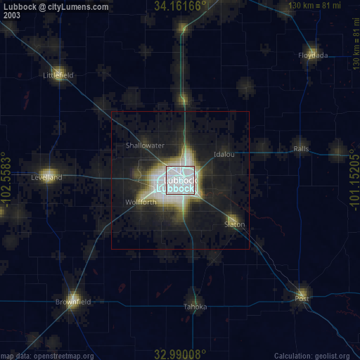
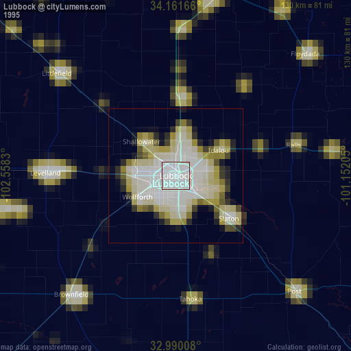
Lubbock night lights from space
Night Light of Lubbock (Texas) from space (United States) Src. Average luminocity for 10x10km area is 95.7967% and for 50x50km: 18.6503%.
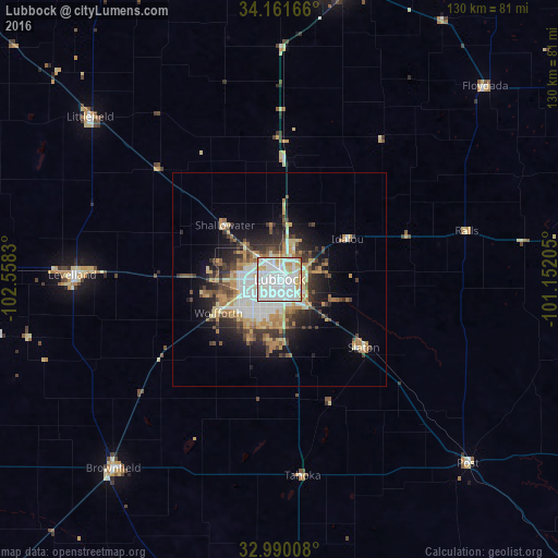
Analysis of Lubbock night lights 2016
Square area 10x10 km:
 46.52%
90-99
38.64%80-89
7.14%70-79
6.78%60-69
0.92%50-59
0%40-49
0%30-39
0%20-29
0%10-19
0%0-9
0%Square area 50x50 km:
3.8%90-99
3.74%80-89
2.35%70-79
2.83%60-69
2.44%50-59
1.6%40-49
2.25%30-39
2.77%20-29
3.72%10-19
6.65%0-9
67.84%Clear (daylight) street map image can be seen on geolist.org.
Map coordinates:
34° 9' 42" North, 102° 33' 29.9" West
33° 34' 40.3" North, 101° 51' 18.6" West
32° 59' 24.3" North, 101° 9' 7.4" West
Some cities around Lubbock sort by population:
• Plainview
68.9 km =42.8 mi,  11°
11°
• Levelland
48.4 km =30.1 mi,  271°
271°
• Brownfield
58.8 km =36.5 mi,  221°
221°
• Lamesa
93.9 km =58.3 mi,  185°
185°
• Littlefield
57.5 km =35.7 mi,  310°
310°
• Slaton
25.1 km =15.6 mi,  128°
128°
• Post
61.7 km =38.3 mi, 134°
• Muleshoe
107.8 km =67 mi, 311°
5525577 (p: 249,042)
Sources (retrieved 2019-11-25):
» NASA, Earths city lights 1995
» NASA city lights 2003
» Earth at Night: Flat Maps 2012, 2016