Mount Lebanon night lights from space
Night Light of Mount Lebanon (Pennsylvania) from space (United States) Src. Average luminocity for 10x10km area is 80.6003% and for 50x50km: 51.7202%.
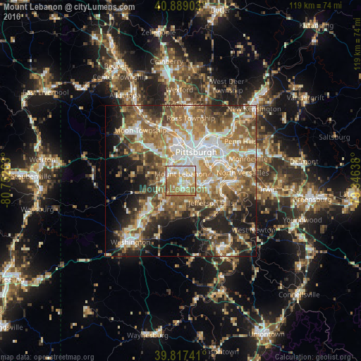
Analysis of Mount Lebanon night lights 2016
Square area 10x10 km:
 14.29%
90-99
23.64%80-89
12.59%70-79
17.01%60-69
24.66%50-59
6.8%40-49
0.85%30-39
0.17%20-29
0%10-19
0%0-9
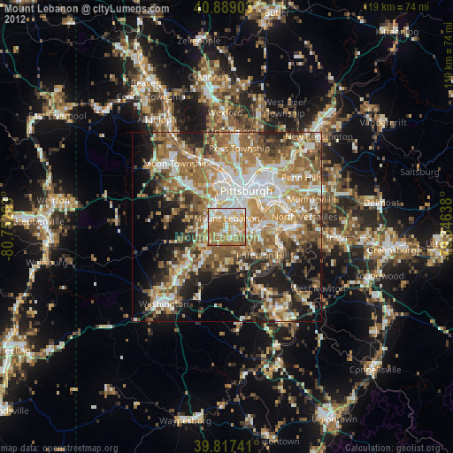
0%Square area 50x50 km:
8.71%90-99
9.69%80-89
6.18%70-79
7.61%60-69
10.77%50-59
11.08%40-49
7.77%30-39
6%20-29
9.04%10-19
10.85%0-9
12.3%Clear (daylight) street map image can be seen on geolist.org.
Map coordinates:
40° 53' 20.5" North, 80° 45' 9.5" West
40° 21' 19.3" North, 80° 2' 58.2" West
39° 49' 2.7" North, 79° 20' 47" West
Some cities around Mount Lebanon sort by population:
• Bethel Park
3.2 km =2 mi,  164°
164°
• Baldwin
6.3 km =3.9 mi,  107°
107°
• Upper Saint Clair
3.6 km =2.2 mi,  233°
233°
• Whitehall
5 km =3.1 mi,  82°
82°
• Dormont
4.7 km =2.9 mi,  17°
17°
• Castle Shannon
2.5 km =1.6 mi,  65°
65°
• Bridgeville
5.1 km =3.2 mi,  271°
271°
• Bryn Mawr
6.5 km =4 mi,  208°
208°
5202215 (p: 32,730)
Sources (retrieved 2019-11-25):
» Earth at Night: Flat Maps 2012, 2016