Bellaire night lights from space
Night Light of Bellaire (Texas) from space (United States) Src. Average luminocity for 10x10km area is 99.8611% and for 50x50km: 89.4741%.
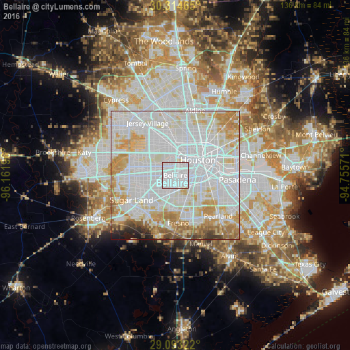
Analysis of Bellaire night lights 2016
Square area 10x10 km:
 88.49%
90-99
11.51%80-89
0%70-79
0%60-69
0%50-59
0%40-49
0%30-39
0%20-29
0%10-19
0%0-9
0%Square area 50x50 km:
44.82%90-99
24.72%80-89
9.2%70-79
8.71%60-69
5.4%50-59
2.71%40-49
1.42%30-39
0.87%20-29
1.12%10-19
1.02%0-9
0.01%Clear (daylight) street map image can be seen on geolist.org.
Map coordinates:
30° 18' 52.7" North, 96° 9' 43.1" West
29° 42' 20.8" North, 95° 27' 31.8" West
29° 5' 35.6" North, 94° 45' 20.6" West
Some cities around Bellaire sort by population:
• Houston
11.2 km =7 mi,  55°
55°
• Alief
13.3 km =8.3 mi,  272°
272°
• Sugar Land
19.5 km =12.1 mi,  240°
240°
• Missouri City
12.3 km =7.6 mi,  218°
218°
• Fresno
18.6 km =11.6 mi,  176°
176°
• Stafford
13.8 km =8.6 mi, 223°
• West University Place
2.8 km =1.7 mi, 60°
• Four Corners
19.7 km =12.2 mi,  257°
257°
4673353 (p: 18,518)
Sources (retrieved 2019-11-25):
» Earth at Night: Flat Maps 2012, 2016