Alief night lights from space
Night Light of Alief (Texas) from space (United States) Src. Average luminocity for 10x10km area is 99.5516% and for 50x50km: 84.3701%.
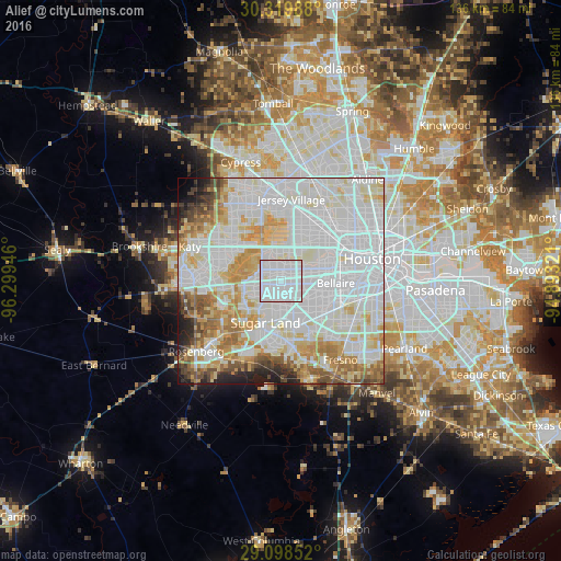
Analysis of Alief night lights 2016
Square area 10x10 km:
 74.6%
74.6%90-99
24.6%80-89
0.79%70-79
0%60-69
0%50-59
0%40-49
0%30-39
0%20-29
0%10-19
0%0-9
0%Square area 50x50 km:
39.3%90-99
22.79%80-89
9.38%70-79
7.62%60-69
6.14%50-59
4.05%40-49
3.2%30-39
1.93%20-29
2.68%10-19
2.25%0-9
0.66%Clear (daylight) street map image can be seen on geolist.org.
Map coordinates:
30° 19' 11.6" North, 96° 17' 58.1" West
29° 42' 39.8" North, 95° 35' 46.8" West
29° 5' 54.7" North, 94° 53' 35.6" West
Some cities around Alief sort by population:
• Sugar Land
10.8 km =6.7 mi,  200°
200°
• Missouri City
11.7 km =7.3 mi,  151°
151°
• Mission Bend
6.9 km =4.3 mi,  253°
253°
• Bellaire
13.3 km =8.3 mi,  92°
92°
• Stafford
11.2 km =7 mi,  160°
160°
• West University Place
15.7 km =9.8 mi, 87°
• New Territory
15.4 km =9.6 mi,  212°
212°
• Four Corners
7.6 km =4.7 mi,  231°
231°
4670249 (p: 98,725)
Sources (retrieved 2019-11-25):
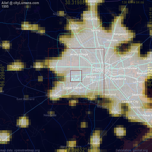
» NASA, Earths city lights 1995
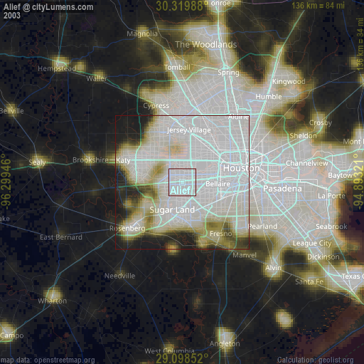
» NASA city lights 2003
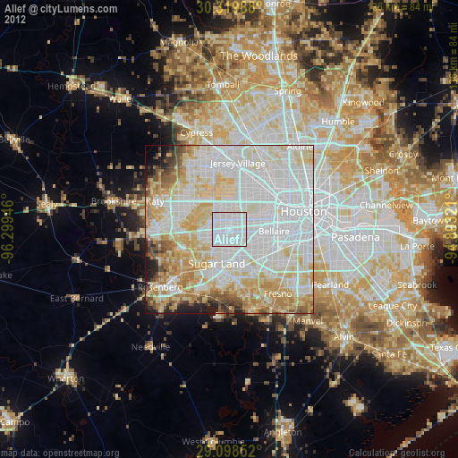
» Earth at Night: Flat Maps 2012, 2016