Stafford night lights from space
Night Light of Stafford (Texas) from space (United States) Src. Average luminocity for 10x10km area is 96.8869% and for 50x50km: 71.4252%.
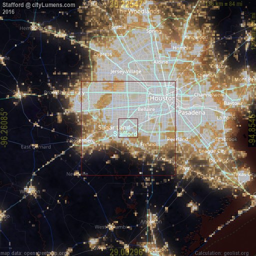
Analysis of Stafford night lights 2016
Square area 10x10 km:
 58.33%
90-99
26.59%80-89
14.09%70-79
0.99%60-69
0%50-59
0%40-49
0%30-39
0%20-29
0%10-19
0%0-9
0%Square area 50x50 km:
32.39%90-99
17.08%80-89
8.08%70-79
7.73%60-69
6.07%50-59
4.02%40-49
2.96%30-39
2.11%20-29
2.96%10-19
4.77%0-9
11.84%Clear (daylight) street map image can be seen on geolist.org.
Map coordinates:
30° 13' 31.7" North, 96° 15' 39.1" West
29° 36' 57.9" North, 95° 33' 27.8" West
29° 0' 10.7" North, 94° 51' 16.6" West
Some cities around Stafford sort by population:
• Alief
11.2 km =7 mi,  340°
340°
• Sugar Land
7.5 km =4.7 mi,  273°
273°
• Missouri City
2 km =1.2 mi,  81°
81°
• Mission Bend
13.5 km =8.4 mi,  309°
309°
• Fresno
13.7 km =8.5 mi,  128°
128°
• New Territory
12.1 km =7.5 mi,  258°
258°
• Four Corners
11.3 km =7 mi,  301°
301°
• Greatwood
13.3 km =8.3 mi,  238°
238°
4734005 (p: 18,459)
Sources (retrieved 2019-11-25):
» Earth at Night: Flat Maps 2012, 2016