Missouri City night lights from space
Night Light of Missouri City (Texas) from space (United States) Src. Average luminocity for 10x10km area is 96.9524% and for 50x50km: 73.12%.
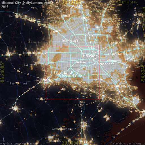
Analysis of Missouri City night lights 2016
Square area 10x10 km:
 60.71%
90-99
25.4%80-89
10.52%70-79
2.78%60-69
0.6%50-59
0%40-49
0%30-39
0%20-29
0%10-19
0%0-9
0%Square area 50x50 km:
34.02%90-99
17.38%80-89
8.09%70-79
7.72%60-69
5.95%50-59
3.87%40-49
2.83%30-39
2.18%20-29
2.95%10-19
4.66%0-9
10.35%Clear (daylight) street map image can be seen on geolist.org.
Map coordinates:
30° 13' 40.7" North, 96° 14' 27.1" West
29° 37' 6.9" North, 95° 32' 15.8" West
29° 0' 19.7" North, 94° 50' 4.6" West
Some cities around Missouri City sort by population:
• Alief
11.7 km =7.3 mi,  331°
331°
• Sugar Land
9.4 km =5.8 mi,  270°
270°
• Fresno
12.4 km =7.7 mi,  135°
135°
• Bellaire
12.3 km =7.6 mi,  38°
38°
• Stafford
2 km =1.2 mi,  261°
261°
• West University Place
14.9 km =9.3 mi, 42°
• New Territory
14.1 km =8.8 mi, 258°
• Four Corners
12.9 km =8 mi,  295°
295°
4711801 (p: 74,139)
Sources (retrieved 2019-11-25):
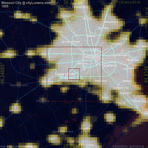
» NASA, Earths city lights 1995
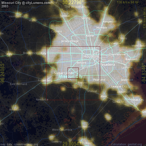
» NASA city lights 2003
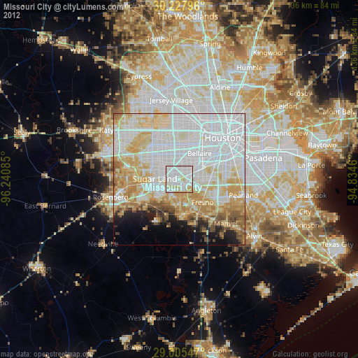
» Earth at Night: Flat Maps 2012, 2016