Bartlett night lights from space
Night Light of Bartlett (Illinois) from space (United States) Src. Average luminocity for 10x10km area is 80.9476% and for 50x50km: 73.2997%.
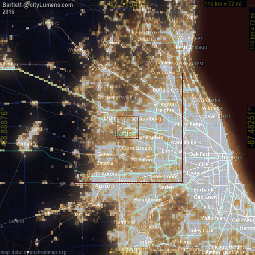
Analysis of Bartlett night lights 2016
Square area 10x10 km:
 14.6%
14.6%90-99
18.73%80-89
19.21%70-79
22.06%60-69
17.94%50-59
5.24%40-49
2.22%30-39
0%20-29
0%10-19
0%0-9
0%Square area 50x50 km:
18.42%90-99
18.93%80-89
12.97%70-79
10.81%60-69
11.84%50-59
9.34%40-49
5.06%30-39
2.95%20-29
3.45%10-19
3.96%0-9
2.29%Clear (daylight) street map image can be seen on geolist.org.
Map coordinates:
42° 30' 55.6" North, 88° 53' 19.5" West
41° 59' 42.1" North, 88° 11' 8.3" West
41° 28' 13.2" North, 87° 28' 57" West
Some cities around Bartlett sort by population:
• Elgin
9.2 km =5.7 mi,  300°
300°
• Schaumburg
9.5 km =5.9 mi,  63°
63°
• Streamwood
3.4 km =2.1 mi,  9°
9°
• Carol Stream
10.1 km =6.3 mi,  155°
155°
• Hanover Park
3.4 km =2.1 mi,  81°
81°
• Roselle
8.8 km =5.5 mi,  97°
97°
• South Elgin
8.8 km =5.5 mi,  269°
269°
• Bloomingdale
9.6 km =6 mi,  115°
115°
4884141 (p: 41,545)
Sources (retrieved 2019-11-25):
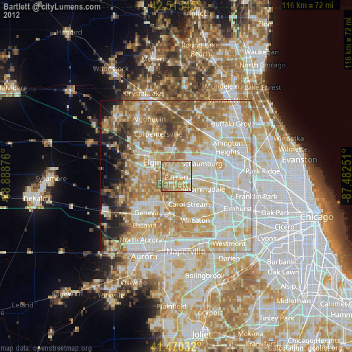
» Earth at Night: Flat Maps 2012, 2016