Barstow night lights from space
Night Light of Barstow (California) from space (United States) Src. Average luminocity for 10x10km area is 38.4652% and for 50x50km: 2.71%.

Analysis of Barstow night lights 2016
Square area 10x10 km:
 5.31%
5.31%90-99
4.58%80-89
1.47%70-79
5.31%60-69
9.71%50-59
7.69%40-49
10.07%30-39
3.66%20-29
7.14%10-19
33.88%0-9
11.17%Square area 50x50 km:
0.24%90-99
0.23%80-89
0.08%70-79
0.28%60-69
0.54%50-59
0.6%40-49
0.74%30-39
0.35%20-29
0.51%10-19
2.38%0-9
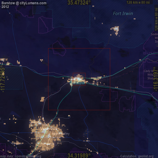
94.05%Clear (daylight) street map image can be seen on geolist.org.
Map coordinates:
35° 28' 23.7" North, 117° 43' 33.4" West
34° 53' 54.9" North, 117° 1' 22.2" West
34° 19' 11.6" North, 116° 19' 10.9" West
Some cities around Barstow sort by population:
• Victorville
47.2 km =29.3 mi,  211°
211°
• Hesperia
58.3 km =36.2 mi, 205°
• Apple Valley
46.7 km =29 mi,  198°
198°
• Adelanto
49.8 km =30.9 mi,  225°
225°
• Fort Irwin
50.9 km =31.6 mi,  37°
37°
• Spring Valley Lake
50.3 km =31.3 mi, 206°
• Lucerne Valley
50.8 km =31.6 mi,  174°
174°
• Silver Lakes
33.7 km =20.9 mi,  239°
239°
5326297 (p: 23,692)
Sources (retrieved 2019-11-25):
» Earth at Night: Flat Maps 2012, 2016