Aurora night lights from space
Night Light of Aurora (Illinois) from space (United States) Src. Average luminocity for 10x10km area is 96.0584% and for 50x50km: 54.7006%.
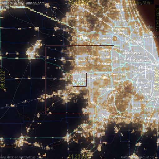
Analysis of Aurora night lights 2016
Square area 10x10 km:
 48.05%
90-99
38.15%80-89
5.68%70-79
7.31%60-69
0.81%50-59
0%40-49
0%30-39
0%20-29
0%10-19
0%0-9
0%Square area 50x50 km:
11.43%90-99
13.03%80-89
10.86%70-79
10.78%60-69
9.16%50-59
4.87%40-49
2.85%30-39
3.07%20-29
4.19%10-19
7.34%0-9
22.43%Clear (daylight) street map image can be seen on geolist.org.
Map coordinates:
42° 16' 58.5" North, 89° 1' 23.5" West
41° 45' 38.1" North, 88° 19' 12.3" West
41° 14' 2.2" North, 87° 37' 1" West
Some cities around Aurora sort by population:
• Oswego
9 km =5.6 mi,  196°
196°
• Batavia
10 km =6.2 mi,  3°
3°
• Montgomery
4 km =2.5 mi,  212°
212°
• North Aurora
5.1 km =3.2 mi,  353°
353°
• Warrenville
13.7 km =8.5 mi,  62°
62°
• Sugar Grove
10.3 km =6.4 mi,  270°
270°
• Boulder Hill
5.5 km =3.4 mi,  194°
194°
• Lynwood
10.5 km =6.5 mi,  215°
215°
4883817 (p: 200,661)
Sources (retrieved 2019-11-25):
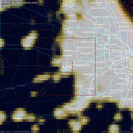
» NASA, Earths city lights 1995
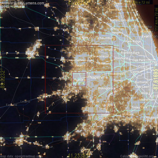
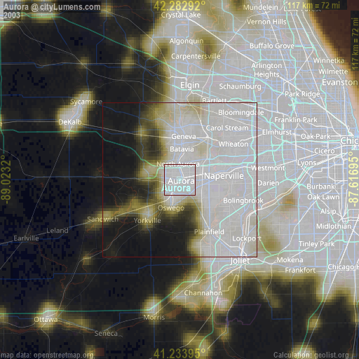
» NASA city lights 2003
» Earth at Night: Flat Maps 2012, 2016