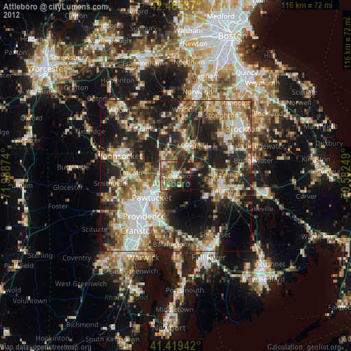
Attleboro night lights from space
Night Light of Attleboro (Massachusetts) from space (United States) Src. Average luminocity for 10x10km area is 54.8651% and for 50x50km: 48.1685%.
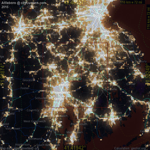
Analysis of Attleboro night lights 2016
Square area 10x10 km:
 6.35%
6.35%90-99
7.14%80-89
4.92%70-79
6.19%60-69
10.79%50-59
19.37%40-49
15.87%30-39
14.13%20-29
10.79%10-19
4.44%0-9
0%Square area 50x50 km:
8.06%90-99
8.07%80-89
5.03%70-79
5.59%60-69
7.71%50-59
9.37%40-49
9.61%30-39
10.47%20-29
15.39%10-19
12.89%0-9
7.8%Clear (daylight) street map image can be seen on geolist.org.
Map coordinates:
42° 27' 55.3" North, 71° 59' 19.5" West
41° 56' 40.3" North, 71° 17' 8.2" West
41° 25' 9.9" North, 70° 34' 57" West
Some cities around Attleboro sort by population:
• Pawtucket
10.9 km =6.8 mi,  227°
227°
• Mansfield
11.3 km =7 mi,  29°
29°
• Norton
8.5 km =5.3 mi,  73°
73°
• Central Falls
10.7 km =6.6 mi,  235°
235°
• North Attleborough Center
4.5 km =2.8 mi,  313°
313°
• Valley Falls
9.6 km =6 mi, 244°
• Plainville
7.7 km =4.8 mi,  329°
329°
• Mansfield Center
10.3 km =6.4 mi, 32°
4929399 (p: 44,284)
Sources (retrieved 2019-11-25):
» Earth at Night: Flat Maps 2012, 2016