Artondale night lights from space
Night Light of Artondale (Washington) from space (United States) Src. Average luminocity for 10x10km area is 20.5833% and for 50x50km: 26.4991%.
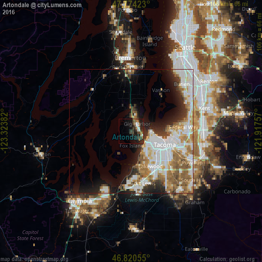
Analysis of Artondale night lights 2016
Square area 10x10 km:
 2.38%
2.38%90-99
2.98%80-89
0.6%70-79
1.64%60-69
2.98%50-59
2.83%40-49
4.02%30-39
7.59%20-29
8.33%10-19
18.6%0-9
48.07%Square area 50x50 km:
7.26%90-99
6.17%80-89
2.34%70-79
3.01%60-69
3.76%50-59
4.01%40-49
2.35%30-39
2.27%20-29
4.18%10-19
7.29%0-9
57.36%Clear (daylight) street map image can be seen on geolist.org.
Map coordinates:
47° 46' 27.2" North, 123° 19' 25.8" West
47° 17' 58.3" North, 122° 37' 14.5" West
46° 49' 14" North, 121° 55' 3.3" West
Some cities around Artondale sort by population:
• Tacoma
14.3 km =8.9 mi,  111°
111°
• Lakewood
16.2 km =10.1 mi,  151°
151°
• University Place
8.9 km =5.5 mi,  143°
143°
• Gig Harbor
4.5 km =2.8 mi,  42°
42°
• Fircrest
10.3 km =6.4 mi,  130°
130°
• Wollochet
4.4 km =2.7 mi, 141°
• Steilacoom
14.5 km =9 mi,  174°
174°
• Maplewood
12.3 km =7.6 mi,  22°
22°
5785909 (p: 12,653)
Sources (retrieved 2019-11-25):
» Earth at Night: Flat Maps 2012, 2016