Steilacoom night lights from space
Night Light of Steilacoom (Washington) from space (United States) Src. Average luminocity for 10x10km area is 35.7723% and for 50x50km: 29.9281%.
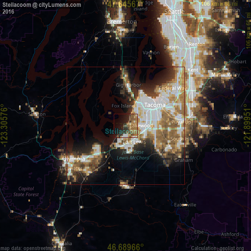
Analysis of Steilacoom night lights 2016
Square area 10x10 km:
 1.93%
1.93%90-99
3.27%80-89
3.42%70-79
4.32%60-69
14.73%50-59
9.52%40-49
6.25%30-39
3.27%20-29
11.76%10-19
17.26%0-9
24.26%Square area 50x50 km:
7%90-99
5.99%80-89
2.46%70-79
4.07%60-69
4.97%50-59
5.19%40-49
3.23%30-39
3.24%20-29
5.51%10-19
9.68%0-9
48.66%Clear (daylight) street map image can be seen on geolist.org.
Map coordinates:
47° 38' 44.4" North, 123° 18' 20.7" West
47° 10' 11.4" North, 122° 36' 9.5" West
46° 41' 22.8" North, 121° 53' 58.2" West
Some cities around Steilacoom sort by population:
• Lakewood
6.4 km =4 mi,  88°
88°
• Parkland
12.8 km =8 mi,  97°
97°
• University Place
8.3 km =5.2 mi,  28°
28°
• Artondale
14.5 km =9 mi,  354°
354°
• Joint Base Lewis McChord
7.2 km =4.5 mi,  164°
164°
• DuPont
8.4 km =5.2 mi,  194°
194°
• Fircrest
10.1 km =6.3 mi,  40°
40°
• Wollochet
11.1 km =6.9 mi,  7°
7°
5812092 (p: 6,211)
Sources (retrieved 2019-11-25):
» Earth at Night: Flat Maps 2012, 2016