Aloha night lights from space
Night Light of Aloha (Oregon) from space (United States) Src. Average luminocity for 10x10km area is 80.1714% and for 50x50km: 38.0746%.
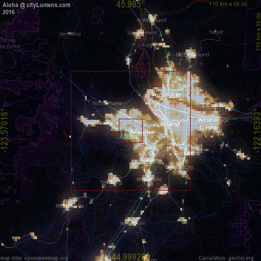
Analysis of Aloha night lights 2016
Square area 10x10 km:
 27.46%
90-99
24.76%80-89
10.79%70-79
13.49%60-69
4.76%50-59
3.81%40-49
2.54%30-39
4.44%20-29
5.24%10-19
2.7%0-9
0%Square area 50x50 km:
10.16%90-99
10.37%80-89
4.81%70-79
4.96%60-69
4.25%50-59
3.6%40-49
2.42%30-39
2.91%20-29
4.85%10-19
10.59%0-9
41.08%Clear (daylight) street map image can be seen on geolist.org.
Map coordinates:
45° 59' 6" North, 123° 34' 12.6" West
45° 29' 39.4" North, 122° 52' 1.4" West
44° 59' 57.3" North, 122° 9' 50.1" West
Some cities around Aloha sort by population:
• Beaverton
5 km =3.1 mi,  99°
99°
• Bethany
7.1 km =4.4 mi,  359°
359°
• Cedar Mill
5.5 km =3.4 mi,  52°
52°
• Oak Hills
5.6 km =3.5 mi,  21°
21°
• Rockcreek
6.3 km =3.9 mi,  352°
352°
• Cedar Hills
5.5 km =3.4 mi,  77°
77°
• West Slope
8 km =5 mi,  86°
86°
• West Haven
8 km =5 mi,  71°
71°
5711099 (p: 49,425)
Sources (retrieved 2019-11-25):
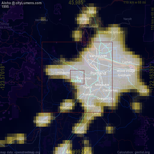
» NASA, Earths city lights 1995
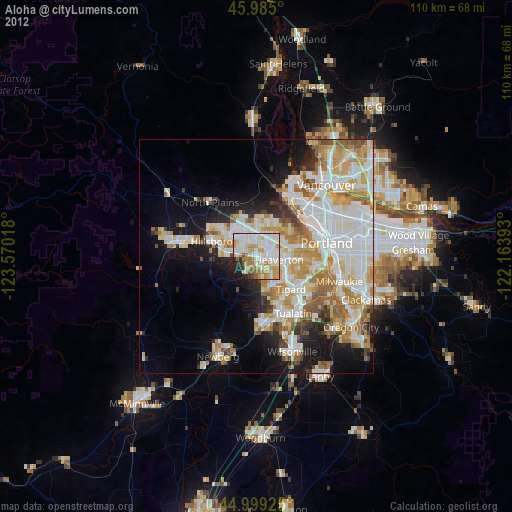
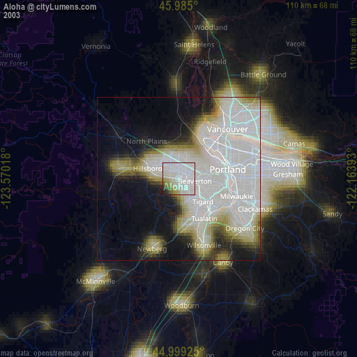
» NASA city lights 2003
» Earth at Night: Flat Maps 2012, 2016