Mission Bend night lights from space
Night Light of Mission Bend (Texas) from space (United States) Src. Average luminocity for 10x10km area is 91.9266% and for 50x50km: 74.0558%.
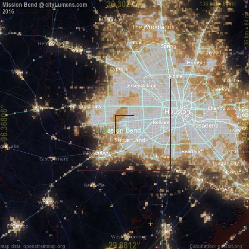
Analysis of Mission Bend night lights 2016
Square area 10x10 km:
 35.12%
90-99
35.52%80-89
7.74%70-79
16.27%60-69
5.36%50-59
0%40-49
0%30-39
0%20-29
0%10-19
0%0-9
0%Square area 50x50 km:
30.46%90-99
19.78%80-89
8.77%70-79
7.8%60-69
6.29%50-59
4.27%40-49
3.49%30-39
2.98%20-29
4.42%10-19
5.8%0-9
5.93%Clear (daylight) street map image can be seen on geolist.org.
Map coordinates:
30° 18' 10" North, 96° 22' 5.1" West
29° 41' 37.8" North, 95° 39' 53.8" West
29° 4' 52.3" North, 94° 57' 42.6" West
Some cities around Mission Bend sort by population:
• Alief
6.9 km =4.3 mi,  73°
73°
• Sugar Land
8.7 km =5.4 mi,  160°
160°
• Missouri City
14.9 km =9.3 mi,  124°
124°
• Stafford
13.5 km =8.4 mi,  129°
129°
• Cinco Ranch
10.3 km =6.4 mi,  299°
299°
• Pecan Grove
9.9 km =6.2 mi,  220°
220°
• New Territory
11.2 km =7 mi,  187°
187°
• Four Corners
2.9 km =1.8 mi,  166°
166°
4711729 (p: 36,501)
Sources (retrieved 2019-11-25):
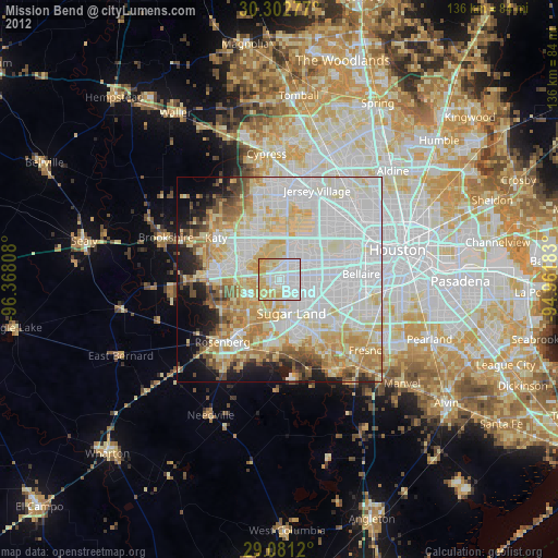
» Earth at Night: Flat Maps 2012, 2016