Lafayette night lights from space
Night Light of Lafayette (Louisiana) from space (United States) Src. Average luminocity for 10x10km area is 92.035% and for 50x50km: 36.4918%.
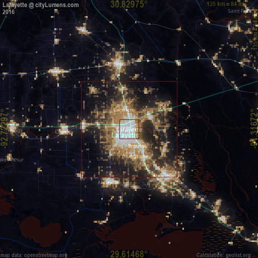
Analysis of Lafayette night lights 2016
Square area 10x10 km:
 58.74%
90-99
18.36%80-89
2.8%70-79
6.64%60-69
8.22%50-59
4.72%40-49
0.52%30-39
0%20-29
0%10-19
0%0-9
0%Square area 50x50 km:
5.26%90-99
3.87%80-89
4.1%70-79
4.89%60-69
7.49%50-59
7.22%40-49
7.08%30-39
7.45%20-29
10.34%10-19
17.23%0-9
25.06%Clear (daylight) street map image can be seen on geolist.org.
Map coordinates:
30° 49' 47.1" North, 92° 43' 22.7" West
30° 13' 26.7" North, 92° 1' 11.4" West
29° 36' 52.8" North, 91° 19' 0.2" West
Some cities around Lafayette sort by population:
• Abbeville
29.8 km =18.5 mi,  201°
201°
• Youngsville
14.1 km =8.8 mi,  168°
168°
• Broussard
10.2 km =6.3 mi,  146°
146°
• Scott
7.3 km =4.5 mi,  280°
280°
• Carencro
10.7 km =6.6 mi,  344°
344°
• Breaux Bridge
12.8 km =8 mi,  64°
64°
• Rayne
23.9 km =14.9 mi,  272°
272°
• Saint Martinville
21 km =13 mi,  121°
121°
4330145 (p: 127,657)
Sources (retrieved 2019-11-25):
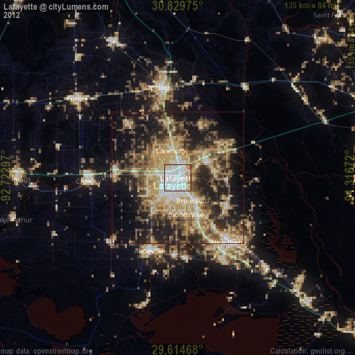
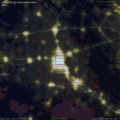
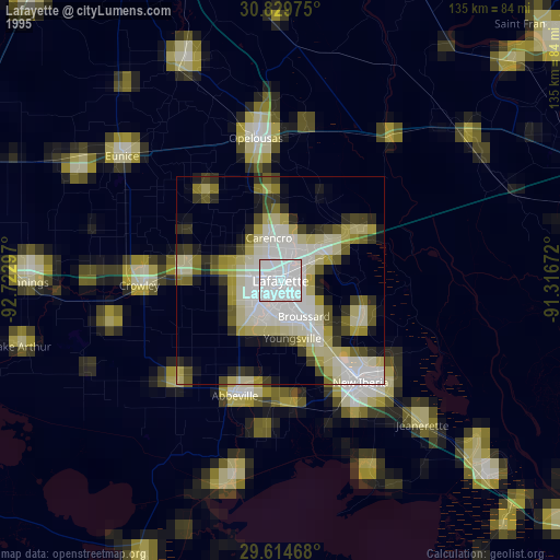
» NASA, Earths city lights 1995
» NASA city lights 2003
» Earth at Night: Flat Maps 2012, 2016