Mukono night lights from space
Night Light of Mukono (Central Region) from space (Uganda) Src. Average luminocity for 10x10km area is 10.0736% and for 50x50km: 11.0145%.
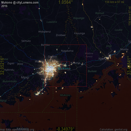
Analysis of Mukono night lights 2016
Square area 10x10 km:
 0%
0%90-99
0%80-89
0.87%70-79
0%60-69
1.08%50-59
2.38%40-49
1.73%30-39
4.98%20-29
5.41%10-19
9.74%0-9
73.81%Square area 50x50 km:
1.5%90-99
1.92%80-89
1.13%70-79
1.64%60-69
2.3%50-59
1.87%40-49
1.97%30-39
1.77%20-29
1.88%10-19
4.39%0-9
79.63%Clear (daylight) street map image can be seen on geolist.org.
Map coordinates:
1° 3' 23" North, 32° 3' 7.8" East
0° 21' 12" North, 32° 45' 19" East
0° 20' 59.2" South, 33° 27' 30.3" East
Some cities around Mukono sort by population:
• Kampala
19.7 km =12.2 mi,  257°
257°
• Entebbe
45.1 km =28 mi,  222°
222°
• Lugazi
20.3 km =12.6 mi,  85°
85°
• Kayunga
41.6 km =25.8 mi,  20°
20°
• Wakiso
33.4 km =20.8 mi,  279°
279°
• Kireka
11.8 km =7.3 mi,  266°
266°
• Bweyogerere
10.2 km =6.3 mi, 272°
• Kajansi
28.9 km =18 mi,  238°
238°
228853 (p: 67,290)
Sources (retrieved 2019-11-25):
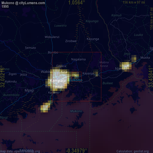
» NASA, Earths city lights 1995
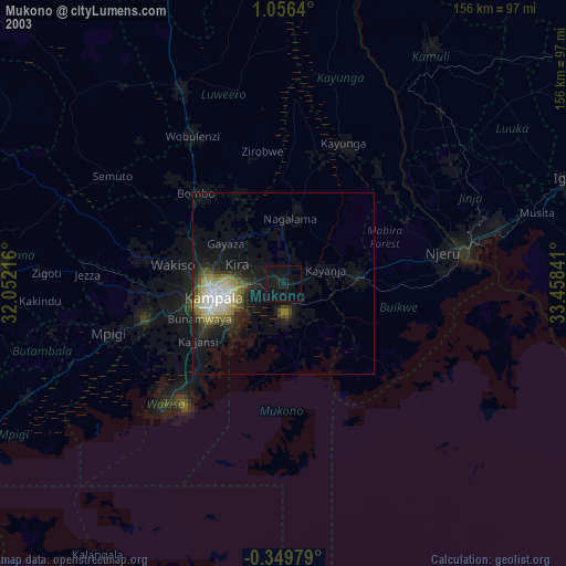
» NASA city lights 2003
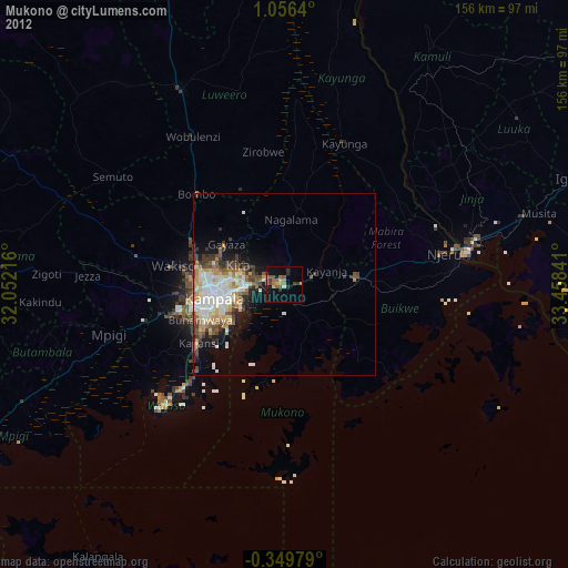
» Earth at Night: Flat Maps 2012, 2016