Wakiso night lights from space
Night Light of Wakiso (Central Region) from space (Uganda) Src. Average luminocity for 10x10km area is 5.7792% and for 50x50km: 12.0016%.

Analysis of Wakiso night lights 2016
Square area 10x10 km:
 0%
0%90-99
0%80-89
0%70-79
0.87%60-69
0%50-59
0.65%40-49
1.08%30-39
1.52%20-29
4.76%10-19
8.44%0-9
82.68%Square area 50x50 km:
1.51%90-99
1.93%80-89
1.03%70-79
1.68%60-69
2.56%50-59
2.1%40-49
2.61%30-39
2.27%20-29
2.63%10-19
5.21%0-9
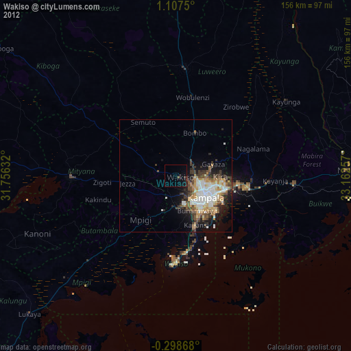
76.47%Clear (daylight) street map image can be seen on geolist.org.
Map coordinates:
1° 6' 27" North, 31° 45' 22.8" East
0° 24' 16" North, 32° 27' 34" East
0° 17' 55.2" South, 33° 9' 45.3" East
Some cities around Wakiso sort by population:
• Kampala
16.8 km =10.4 mi,  125°
125°
• Mukono
33.4 km =20.8 mi,  99°
99°
• Wobulenzi
36.5 km =22.7 mi,  9°
9°
• Namasuba
32 km =19.9 mi,  352°
352°
• Kireka
22 km =13.7 mi,  106°
106°
• Bweyogerere
23.3 km =14.5 mi, 102°
• Mpigi
25.7 km =16 mi,  219°
219°
• Kajansi
22.6 km =14 mi,  158°
158°
225964 (p: 20,530)
Sources (retrieved 2019-11-25):
» Earth at Night: Flat Maps 2012, 2016