Volodarka night lights from space
Night Light of Volodarka (Kyiv) from space (Ukraine) Src. Average luminocity for 10x10km area is 0% and for 50x50km: 0.0997%.
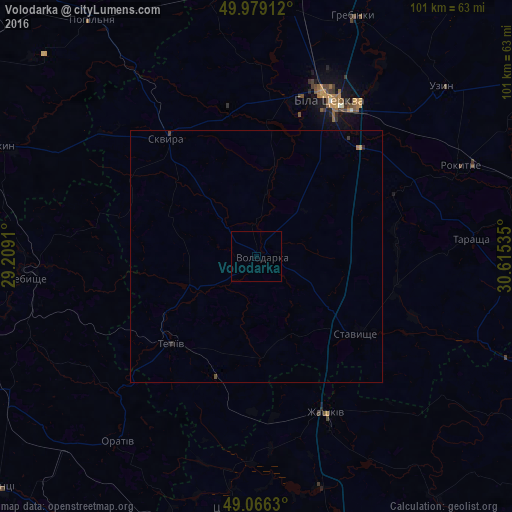
Analysis of Volodarka night lights 2016
Square area 10x10 km:
 0%
0%90-99
0%80-89
0%70-79
0%60-69
0%50-59
0%40-49
0%30-39
0%20-29
0%10-19
0%0-9
100%Square area 50x50 km:
0%90-99
0%80-89
0%70-79
0.02%60-69
0.02%50-59
0%40-49
0.05%30-39
0.02%20-29
0.05%10-19
0.02%0-9
99.82%Clear (daylight) street map image can be seen on geolist.org.
Map coordinates:
49° 58' 44.8" North, 29° 12' 32.8" East
49° 31' 29.4" North, 29° 54' 44" East
49° 3' 58.7" North, 30° 36' 55.3" East
Some cities around Volodarka sort by population:
• Bila Tserkva
34.8 km =21.6 mi,  24°
24°
• Skvyra
29.1 km =18.1 mi,  322°
322°
• Zhashkiv
34.2 km =21.3 mi,  155°
155°
• Tetiiv
24.3 km =15.1 mi,  227°
227°
• Tarashcha
42 km =26.1 mi,  84°
84°
• Uzyn
49.3 km =30.6 mi,  47°
47°
• Pohrebyshche
47 km =29.2 mi,  264°
264°
• Popilnia
58 km =36 mi,  325°
325°
689157 (p: 7,355)
Sources (retrieved 2019-11-25):
» Earth at Night: Flat Maps 2012, 2016