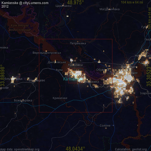
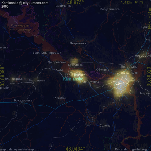
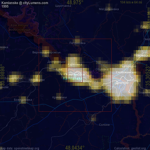
Kamianske night lights from space
Night Light of Kamianske (Dnipropetrovsk) from space (Ukraine) Src. Average luminocity for 10x10km area is 44.0923% and for 50x50km: 4.5063%.
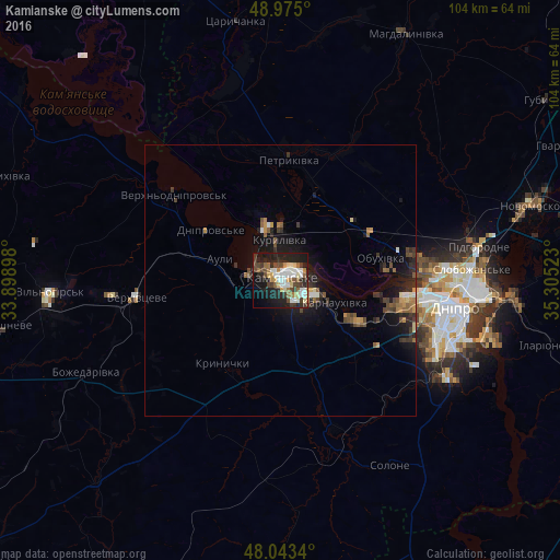
Analysis of Kamianske night lights 2016
Square area 10x10 km:
 8.95%
8.95%90-99
9.94%80-89
3.69%70-79
4.97%60-69
5.11%50-59
3.27%40-49
8.66%30-39
6.25%20-29
16.34%10-19
23.15%0-9
9.66%Square area 50x50 km:
0.43%90-99
0.56%80-89
0.29%70-79
0.62%60-69
0.48%50-59
0.68%40-49
0.92%30-39
0.89%20-29
1.61%10-19
3.96%0-9
89.56%Clear (daylight) street map image can be seen on geolist.org.
Map coordinates:
48° 58' 30" North, 33° 53' 56.3" East
48° 30' 40.8" North, 34° 36' 7.6" East
48° 2' 36.2" North, 35° 18' 18.8" East
Some cities around Kamianske sort by population:
• Dnipro
32.7 km =20.3 mi,  100°
100°
• Novomoskovs’k
49.4 km =30.7 mi,  73°
73°
• Piatykhatky
66.6 km =41.4 mi,  260°
260°
• Pidhorodne
37.8 km =23.5 mi,  79°
79°
• Tsarychanka
48.2 km =30 mi,  349°
349°
• Solone
39.2 km =24.4 mi,  149°
149°
• Mahdalynivka
51 km =31.7 mi,  26°
26°
• Hubynykha
58.4 km =36.3 mi,  55°
55°
709932 (p: 248,575)
Sources (retrieved 2019-11-25):
» NASA, Earths city lights 1995
» NASA city lights 2003
» Earth at Night: Flat Maps 2012, 2016