Terebovlya night lights from space
Night Light of Terebovlya (Ternopil) from space (Ukraine) Src. Average luminocity for 10x10km area is 0.2513% and for 50x50km: 0.4399%.
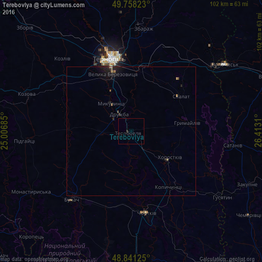
Analysis of Terebovlya night lights 2016
Square area 10x10 km:
 0%
0%90-99
0%80-89
0%70-79
0%60-69
0%50-59
0%40-49
0%30-39
0.53%20-29
0%10-19
0%0-9
99.47%Square area 50x50 km:
0%90-99
0.02%80-89
0.03%70-79
0.03%60-69
0.07%50-59
0.1%40-49
0.01%30-39
0.09%20-29
0.18%10-19
0.7%0-9
98.77%Clear (daylight) street map image can be seen on geolist.org.
Map coordinates:
49° 45' 29.6" North, 25° 0' 24.7" East
49° 18' 6.7" North, 25° 42' 35.9" East
48° 50' 28.5" North, 26° 24' 47.2" East
Some cities around Terebovlya sort by population:
• Ternopil
29.3 km =18.2 mi,  342°
342°
• Chortkiv
32.3 km =20.1 mi,  168°
168°
• Zbarazh
40.5 km =25.2 mi,  6°
6°
• Buchach
35.4 km =22 mi,  221°
221°
• Kozova
43.1 km =26.8 mi,  290°
290°
• Husiatyn
42.9 km =26.7 mi,  126°
126°
• Khorostkiv
18.4 km =11.4 mi,  123°
123°
• Kopychyntsi
26.3 km =16.3 mi,  146°
146°
691693 (p: 13,153)
Sources (retrieved 2019-11-25):
» Earth at Night: Flat Maps 2012, 2016