Khorostkiv night lights from space
Night Light of Khorostkiv (Ternopil) from space (Ukraine) Src. Average luminocity for 10x10km area is 0.7794% and for 50x50km: 0.2115%.
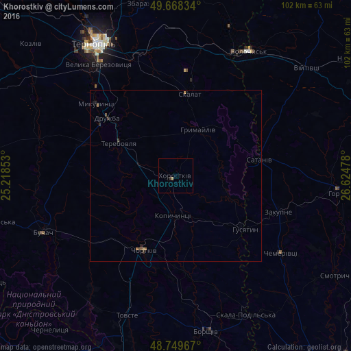
Analysis of Khorostkiv night lights 2016
Square area 10x10 km:
 0%
0%90-99
0%80-89
0.53%70-79
0%60-69
0%50-59
0%40-49
0%30-39
0.53%20-29
0%10-19
0%0-9
98.93%Square area 50x50 km:
0%90-99
0%80-89
0.04%70-79
0.03%60-69
0.06%50-59
0.06%40-49
0.02%30-39
0.11%20-29
0.04%10-19
0.04%0-9
99.6%Clear (daylight) street map image can be seen on geolist.org.
Map coordinates:
49° 40' 6" North, 25° 13' 6.7" East
49° 12' 40.1" North, 25° 55' 17.9" East
48° 44' 58.8" North, 26° 37' 29.2" East
Some cities around Khorostkiv sort by population:
• Ternopil
45 km =28 mi,  327°
327°
• Chortkiv
23.4 km =14.5 mi,  202°
202°
• Horodok
48.4 km =30.1 mi,  96°
96°
• Terebovlya
18.4 km =11.4 mi,  303°
303°
• Buchach
42.2 km =26.2 mi,  246°
246°
• Borshchiv
46.2 km =28.7 mi,  168°
168°
• Husiatyn
24.5 km =15.2 mi,  128°
128°
• Kopychyntsi
11.9 km =7.4 mi,  183°
183°
706271 (p: 7,034)
Sources (retrieved 2019-11-25):
» Earth at Night: Flat Maps 2012, 2016