Dnestrovsc night lights from space
Night Light of Dnestrovsc (Transnistria) from space (Moldova) Src. Average luminocity for 10x10km area is 2.8622% and for 50x50km: 1.1545%.
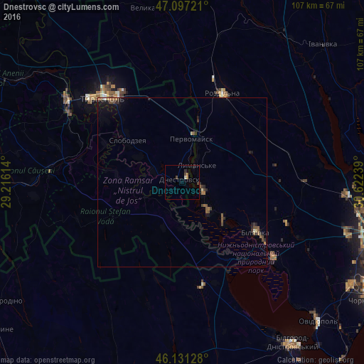
Analysis of Dnestrovsc night lights 2016
Square area 10x10 km:
 0%
0%90-99
0.57%80-89
0%70-79
0.57%60-69
0.43%50-59
0.14%40-49
1.7%30-39
0%20-29
0.57%10-19
0.71%0-9
95.31%Square area 50x50 km:
0.01%90-99
0.08%80-89
0.09%70-79
0.05%60-69
0.23%50-59
0.3%40-49
0.36%30-39
0.22%20-29
0.32%10-19
0.79%0-9
97.55%Clear (daylight) street map image can be seen on geolist.org.
Map coordinates:
47° 5' 50" North, 29° 12' 58.1" East
46° 36' 59" North, 29° 55' 9.3" East
46° 7' 52.6" North, 30° 37' 20.6" East
Some cities around Dnestrovsc sort by population:
• Rozdil’na, UA
28 km =17.4 mi,  25°
25°
• Slobozia
20.6 km =12.8 mi,  307°
307°
• Bilyayivka, UA
27.1 km =16.8 mi,  123°
123°
• Chiţcani
29.6 km =18.4 mi, 308°
• Lymanske, UA
5.7 km =3.5 mi,  39°
39°
• Ştefan Vodă
22.8 km =14.2 mi,  239°
239°
• Pervomaisc
13.3 km =8.3 mi,  14°
14°
• Starokozache, UA
31.5 km =19.6 mi,  170°
170°
618387 (p: 10,426)
Sources (retrieved 2019-11-25):
» Earth at Night: Flat Maps 2012, 2016