Lymanske night lights from space
Night Light of Lymanske (Odesa) from space (Ukraine) Src. Average luminocity for 10x10km area is 2.6591% and for 50x50km: 1.6395%.
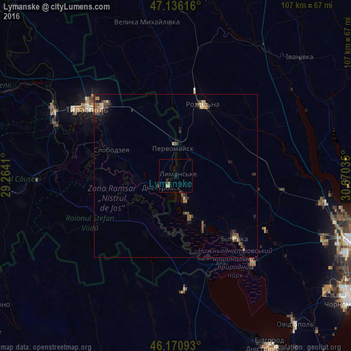
Analysis of Lymanske night lights 2016
Square area 10x10 km:
 0%
0%90-99
0.57%80-89
0%70-79
0.57%60-69
0.43%50-59
0.14%40-49
1.14%30-39
0%20-29
0.85%10-19
0.71%0-9
95.6%Square area 50x50 km:
0.04%90-99
0.14%80-89
0.11%70-79
0.18%60-69
0.3%50-59
0.42%40-49
0.55%30-39
0.36%20-29
0.46%10-19
0.63%0-9
96.83%Clear (daylight) street map image can be seen on geolist.org.
Map coordinates:
47° 8' 10.2" North, 29° 15' 50.8" East
46° 39' 20.5" North, 29° 58' 2" East
46° 10' 15.3" North, 30° 40' 13.3" East
Some cities around Lymanske sort by population:
• Rozdil’na
22.5 km =14 mi,  22°
22°
• Slobozia, MD
21.6 km =13.4 mi,  292°
292°
• Bilyayivka
27.1 km =16.8 mi,  135°
135°
• Dnestrovsc, MD
5.7 km =3.5 mi,  219°
219°
• Chiţcani, MD
30.2 km =18.8 mi,  297°
297°
• Teplodar
32 km =19.9 mi,  121°
121°
• Ştefan Vodă, MD
28.2 km =17.5 mi,  235°
235°
• Pervomaisc, MD
8.6 km =5.3 mi,  357°
357°
703061 (p: 8,600)
Sources (retrieved 2019-11-25):
» Earth at Night: Flat Maps 2012, 2016