Shyroke night lights from space
Night Light of Shyroke (Dnipropetrovsk) from space (Ukraine) Src. Average luminocity for 10x10km area is 6.0997% and for 50x50km: 5.3026%.
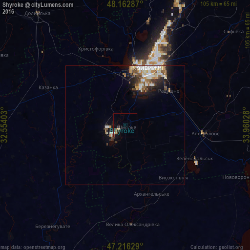
Analysis of Shyroke night lights 2016
Square area 10x10 km:
 0.6%
0.6%90-99
0.45%80-89
0.45%70-79
1.19%60-69
0.6%50-59
1.19%40-49
0.89%30-39
1.79%20-29
2.08%10-19
2.53%0-9
88.24%Square area 50x50 km:
0.95%90-99
1.09%80-89
0.65%70-79
0.54%60-69
0.53%50-59
0.88%40-49
0.71%30-39
0.65%20-29
1.2%10-19
2.62%0-9
90.17%Clear (daylight) street map image can be seen on geolist.org.
Map coordinates:
48° 9' 46.3" North, 32° 33' 14.5" East
47° 41' 30.2" North, 33° 15' 25.7" East
47° 12' 58.6" North, 33° 57' 37" East
Some cities around Shyroke sort by population:
• Kryvyi Rih
25.9 km =16.1 mi,  20°
20°
• Apostolove
34.4 km =21.4 mi,  95°
95°
• Novyy Buh
55.1 km =34.2 mi,  270°
270°
• Kazanka
36.8 km =22.9 mi,  297°
297°
• Bereznehuvate
52.5 km =32.6 mi,  215°
215°
• Velyka Oleksandrivka
41.5 km =25.8 mi,  175°
175°
• Novovorontsovka
53.9 km =33.5 mi,  113°
113°
• Lozuvatka
40.7 km =25.3 mi,  3°
3°
694025 (p: 10,920)
Sources (retrieved 2019-11-25):
» Earth at Night: Flat Maps 2012, 2016