Kryvyi Rih night lights from space
Night Light of Kryvyi Rih (Dnipropetrovsk) from space (Ukraine) Src. Average luminocity for 10x10km area is 77.9034% and for 50x50km: 9.5908%.
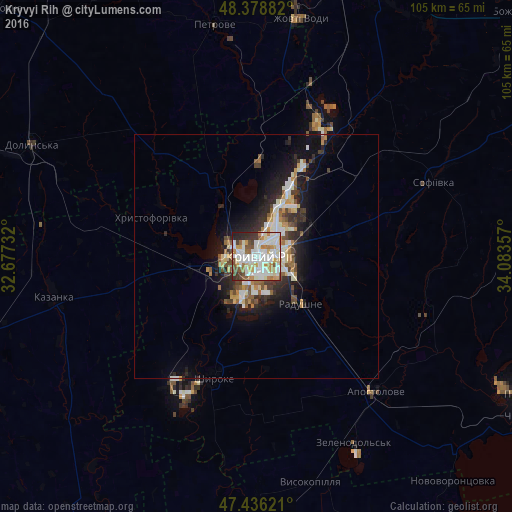
Analysis of Kryvyi Rih night lights 2016
Square area 10x10 km:
 24.29%
90-99
26.56%80-89
7.95%70-79
9.66%60-69
5.68%50-59
7.67%40-49
5.54%30-39
6.25%20-29
5.26%10-19
1.14%0-9
0%Square area 50x50 km:
1.74%90-99
2.17%80-89
0.96%70-79
1.02%60-69
0.94%50-59
1.21%40-49
1.12%30-39
1.31%20-29
2.73%10-19
5.64%0-9
81.14%Clear (daylight) street map image can be seen on geolist.org.
Map coordinates:
48° 22' 43.8" North, 32° 40' 38.4" East
47° 54' 34.8" North, 33° 22' 49.6" East
47° 26' 10.4" North, 34° 5' 0.9" East
Some cities around Kryvyi Rih sort by population:
• Zhovti Vody
49.3 km =30.6 mi,  10°
10°
• Dolyns'ka
51 km =31.7 mi,  295°
295°
• Apostolove
37.3 km =23.2 mi,  138°
138°
• Shyroke
25.9 km =16.1 mi,  200°
200°
• Petrove
47.1 km =29.3 mi,  348°
348°
• Sofiyivka
40 km =24.9 mi,  67°
67°
• Kazanka
42.3 km =26.3 mi,  260°
260°
• Lozuvatka
17.8 km =11.1 mi,  336°
336°
703845 (p: 652,380)
Sources (retrieved 2019-11-25):
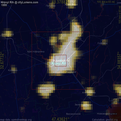
» NASA, Earths city lights 1995
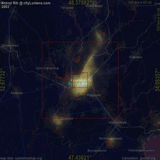
» NASA city lights 2003
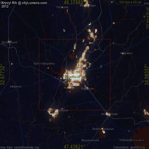
» Earth at Night: Flat Maps 2012, 2016