Kazanka night lights from space
Night Light of Kazanka (Mykolaiv) from space (Ukraine) Src. Average luminocity for 10x10km area is 0% and for 50x50km: 0.2041%.
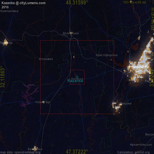
Analysis of Kazanka night lights 2016
Square area 10x10 km:
 0%
0%90-99
0%80-89
0%70-79
0%60-69
0%50-59
0%40-49
0%30-39
0%20-29
0%10-19
0%0-9
100%Square area 50x50 km:
0.01%90-99
0.04%80-89
0%70-79
0%60-69
0.02%50-59
0.08%40-49
0.05%30-39
0.02%20-29
0.07%10-19
0.07%0-9
99.64%Clear (daylight) street map image can be seen on geolist.org.
Map coordinates:
48° 18' 57.6" North, 32° 7' 7.1" East
47° 50' 46.5" North, 32° 49' 18.4" East
47° 22' 20" North, 33° 31' 29.6" East
Some cities around Kazanka sort by population:
• Kryvyi Rih
42.3 km =26.3 mi,  80°
80°
• Dolyns'ka
29.7 km =18.5 mi,  351°
351°
• Novyy Buh
28.2 km =17.5 mi,  232°
232°
• Bashtanka
56.6 km =35.2 mi,  210°
210°
• Shyroke
36.8 km =22.9 mi,  117°
117°
• Bereznehuvate
59.9 km =37.2 mi,  177°
177°
• Lozuvatka
41.8 km =26 mi,  55°
55°
• Novhorodka
59 km =36.7 mi, 348°
706580 (p: 8,010)
Sources (retrieved 2019-11-25):
» Earth at Night: Flat Maps 2012, 2016