Pervomays’k night lights from space
Night Light of Pervomays’k (Mykolaiv) from space (Ukraine) Src. Average luminocity for 10x10km area is 9.6364% and for 50x50km: 0.7589%.
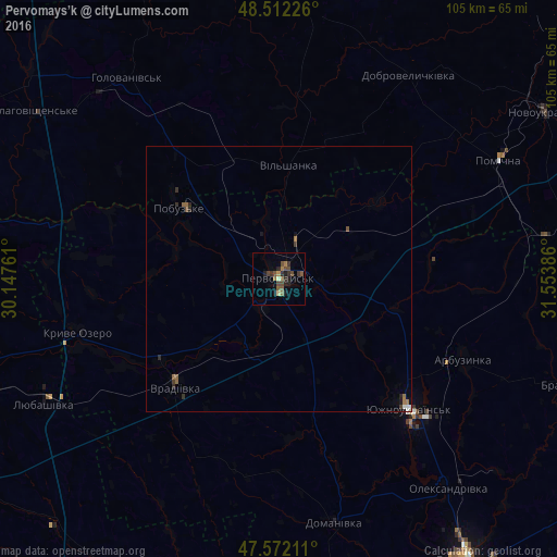
Analysis of Pervomays’k night lights 2016
Square area 10x10 km:
 0%
0%90-99
0.57%80-89
0.57%70-79
0.57%60-69
1.42%50-59
3.13%40-49
4.55%30-39
2.13%20-29
3.13%10-19
2.7%0-9
81.25%Square area 50x50 km:
0.05%90-99
0.06%80-89
0.03%70-79
0.02%60-69
0.16%50-59
0.25%40-49
0.21%30-39
0.19%20-29
0.27%10-19
0.19%0-9
98.58%Clear (daylight) street map image can be seen on geolist.org.
Map coordinates:
48° 30' 44.1" North, 30° 8' 51.4" East
48° 2' 39.6" North, 30° 51' 2.6" East
47° 34' 19.6" North, 31° 33' 13.9" East
Some cities around Pervomays’k sort by population:
• Yuzhnoukrains'k
35.3 km =21.9 mi,  135°
135°
• Pomichna
47.3 km =29.4 mi,  62°
62°
• Vradiyivka
28 km =17.4 mi,  223°
223°
• Lyubashivka
49.7 km =30.9 mi,  242°
242°
• Kryve Ozero
38.7 km =24 mi,  254°
254°
• Arbuzynka
38 km =23.6 mi,  113°
113°
• Domanivka
47 km =29.2 mi,  167°
167°
• Pobugskoye
23.4 km =14.5 mi,  305°
305°
697593 (p: 70,746)
Sources (retrieved 2019-11-25):
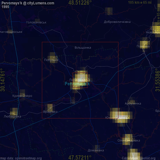
» NASA, Earths city lights 1995
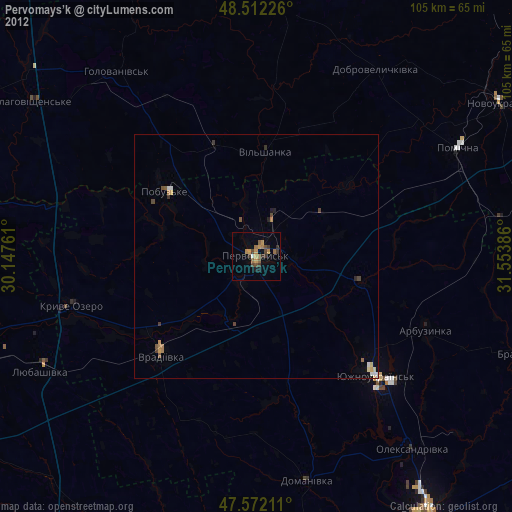
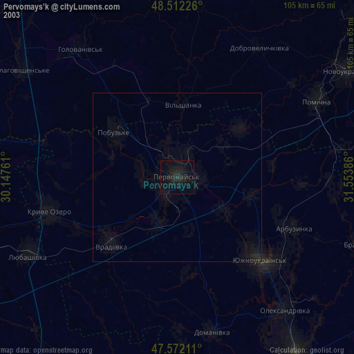
» NASA city lights 2003
» Earth at Night: Flat Maps 2012, 2016