Lutsk night lights from space
Night Light of Lutsk (Volyn) from space (Ukraine) Src. Average luminocity for 10x10km area is 37.2479% and for 50x50km: 1.8092%.
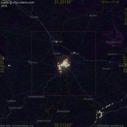
Analysis of Lutsk night lights 2016
Square area 10x10 km:
 4.34%
4.34%90-99
5.6%80-89
6.58%70-79
7.7%60-69
5.18%50-59
4.76%40-49
3.92%30-39
1.96%20-29
9.1%10-19
34.59%0-9
16.25%Square area 50x50 km:
0.17%90-99
0.22%80-89
0.26%70-79
0.32%60-69
0.23%50-59
0.26%40-49
0.19%30-39
0.14%20-29
0.38%10-19
1.82%0-9
96.01%Clear (daylight) street map image can be seen on geolist.org.
Map coordinates:
51° 12' 7.2" North, 24° 38' 21.6" East
50° 45' 33.6" North, 25° 20' 32.8" East
50° 18' 44.7" North, 26° 2' 44.1" East
Some cities around Lutsk sort by population:
• Rivne
64.2 km =39.9 mi,  103°
103°
• Kovel
67.4 km =41.9 mi,  318°
318°
• Dubno
47.1 km =29.3 mi,  143°
143°
• Zdolbuniv
68.8 km =42.8 mi,  112°
112°
• Kivertsi
11.6 km =7.2 mi,  44°
44°
• Rozhyshche
18.1 km =11.2 mi,  343°
343°
• Radyvyliv
70.2 km =43.6 mi,  185°
185°
• Mlyniv
33.9 km =21.1 mi,  145°
145°
702569 (p: 213,661)
Sources (retrieved 2019-11-25):
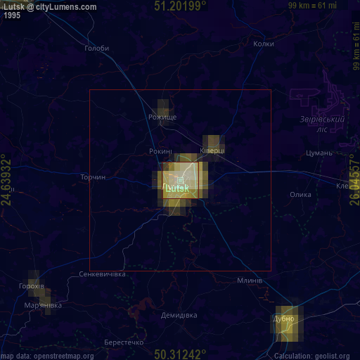
» NASA, Earths city lights 1995
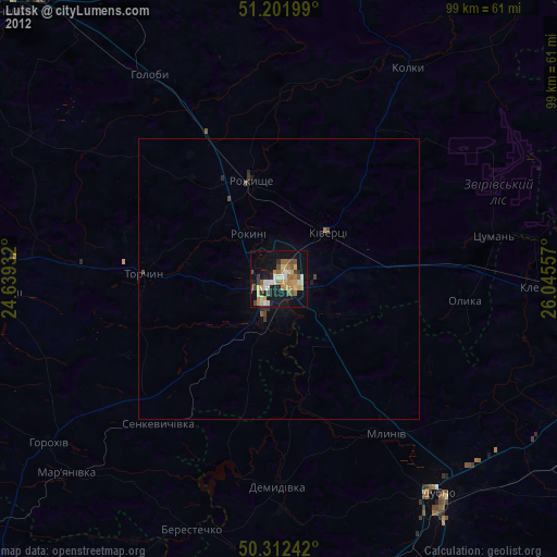
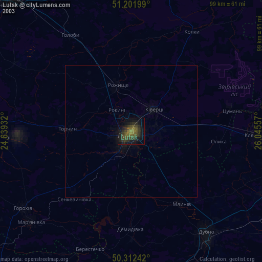
» NASA city lights 2003
» Earth at Night: Flat Maps 2012, 2016